571 résultats pour : sea map
- Page
-
- sur
- 6
Connectez-vous pour plus de résultats
HRM26A15_159
The Chinese Question: map showing positions of chi...
HRM26A14_274
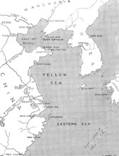
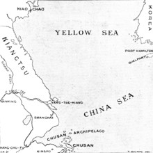
The Chinese Crisis: positions of Port Arthur and K...
HRM26A15_483
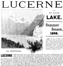
Advertisement for trips to Lake Lucerne, 1898. Cre...
HRM26A15_140
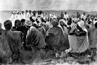
The British Expedition from Accra to the Gold Coas...
HRM26A15_441
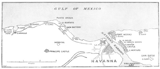
The Spanish-American War: the defences of Havana.....
HRM26A14_305
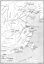
The Chinese Crisis: relative positions of the isla...
HRM26A15_277
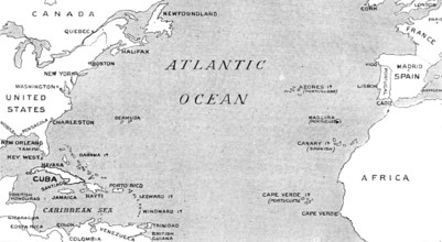
The Spanish-American War: map illustrating the rel...
HRM26A20_427
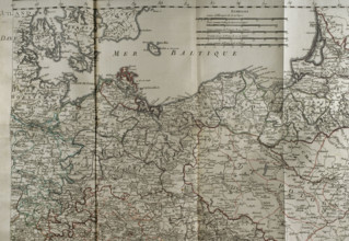
Map of the Baltic Sea coast, Prussia and Poland - ...
HRM26A02_436
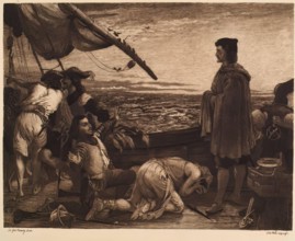
Dawn Revealing the New World to Columbus, (c1852),...
HRM26A08_198
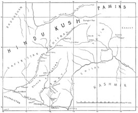
Sketch map of the Chitral Campaign, 1895. Creator:...
HRM26A09_105
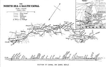
The Opening of the Baltic Canal: map and section o...
HRM25A58_038
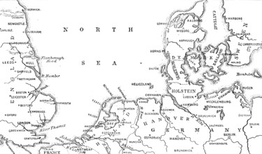
Map showing the position of Heligoland, 1890. Crea...
HRM25A58_085
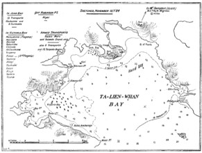
Plan of Ta-Lien-Whan Bay, captured by the Japanese...
HRM25A46_483
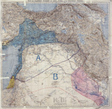
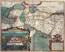
Map showing Eastern Turkey in Asia, Syria and West...
HRM25A47_036
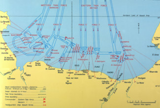
Naval Bombardments on D-Day, Second World War. Cr...

HRM25A46_223
Unity of Strength - Inter-allied posters: 'Liberté...
HRM25A50_202
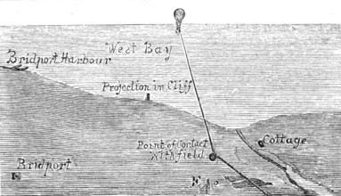
Map of the Balloon Voyage from Hastings to Boulogn...
HRM25A50_392
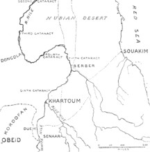
Map of the central region of the Soudan, 1883. Cre...
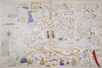
HRM25A47_071
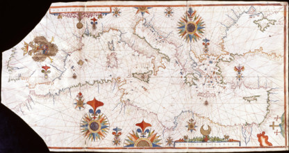
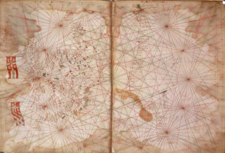
Nautical chart of the Mediterranean Sea, Early16th...
HRM25A46_139
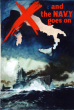
'And the Navy Goes on', British propaganda poster,...
HRM25A41_022
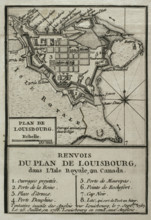
Map of Louisbourg, Nova Scotia, Canada, 1765. Cre...
HRM25A41_016
Seven Years War (1756-1763): Map of the Siege of C...
HRM25A43_071
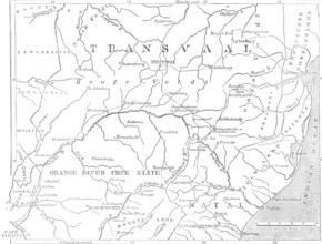
Map of the Transvaal and adjacent provinces, 1881....
HRM25A41_008
Seven Years War (1756-1763): Map of the siege of F...
HRM25A41_026
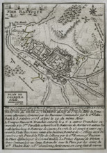
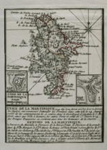
Martinique, 1762 (1765). Creator: Jean de Beaurai...
HRM25A43_287
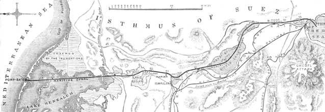
Plan of the Suez Canal, from the Mediterranean to ...
HRM25A41_003
Map of Germany showing war of 1755 to 1763 (Seven ...
HRM25A41_042
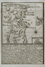
Seven Years War (1756-1763): Battle of Saint-Cast ...
HRM25A40_496
Seven Years War (1756-1763): Map of capture of Bel...
HRM25A41_029
Seven Years War (1756-1763): Map of the Russian bo...
HRM25A40_495
Seven Years War (1756-1763): Map of the fortress o...
HRM25A41_006
Seven Years War (1756-1763): Taking of the island ...
HRM25A41_343
Caspian Sea coast, 1839. Creator: Thunot Duvotena...
HRM25A41_045
Seven Years War (1756-1763): Pomeranian War - Map ...
HRM25A41_099
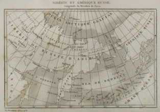
Siberia and Russian America, 1839. Creator: Thuno...
HRM25A42_117
The Fatal Disaster with a Balloon: plan showing th...
HRM25A23_050
Map of Asia Minor and Africa, 1595. Creator: Unkno...
HRM25A23_051
Map of Japan, 1691? Creator: Unknown.
HRM25A23_310
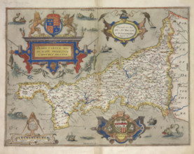
Map of Cornwall, 1579. Creator: Christopher Saxto...
HRM25A23_458
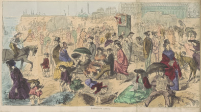
Ramsgate Sands, 1870. Creator: Joseph Swain.
HRM25A24_048
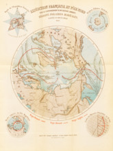
French expedition to the North Pole - Boreal Polar...
HRM25A23_395
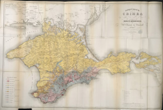
Geological map of the Crimea, 1853. Creator: Unkno...
HRM25A23_433
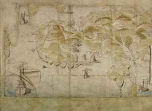
Detail (left-hand end) of a panoramic map of the c...
HRM25A33_012
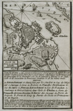
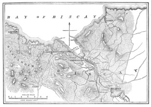
The Civil War in Spain: plan of Bilbao and Somorro...
HRM25A23_182
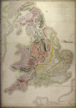
William Smith's geological map of 1815, called A D...
HRM25A32_290
Map of the Strait of Malacca, 1874. Creator: Unkno...
HRM25A23_265
Map of the West Indies and South America, 1683. C...
HRM25A14_490
World map, 1560. Spanish map showing the 'New Worl...

HRM25A15_413
Title page from van Keulen's Chart Atlas, 1682. 'D...
HRM25A16_221
Map of the United States of North America, 1783. D...
HRM25A14_482
Map of Europe, North Africa and the Mediterranean,...
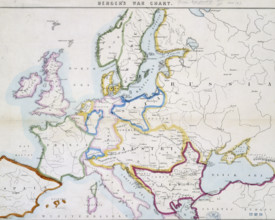
HRM25A14_267
Berger's war chart, 1854. A map of Europe at the t...

HRM25A14_456
Sir Francis Drake, c1743-c1751. Portrait of Drake ...
HRM25A14_492
Chart of the Atlantic Ocean, c1535-1542. The map i...
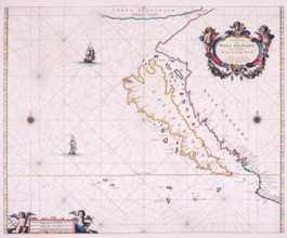
HRM25A15_426
Map of California, 1666. 'Paskaerte Van Nova Grana...
HRM25A16_220
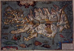
Map of Iceland, 1606. 'Islandia', with volcanos an...
![Map of Great Britain and Ireland, c1564-c1570. 'A general description of England & Irelad [sic]](https://lres.photo12.com/th/t-hrm25a14_268.jpg)
HRM25A14_268
Map of Great Britain and Ireland, c1564-c1570. 'A ...
HRM25A16_258
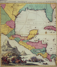
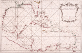
Map showing the Gulf of Mexico and surrounding are...
HRM25A14_377
Map of Eastern Europe and the Byzantine Empire, Ca...
HRM25A15_420
Map of the Atlantic coast of Portugal, 1682. 'Pasc...
HRM25A16_225
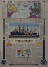
Bacon's Chart of the Atlantic Telegraph, 1866. Map...
HRM25A14_277
Map of the Black Sea coastline, 1536. The coast of...
HRM25A14_486
Map of the Sea of Marmara, 1770. The sea of Marmar...

HRM25A15_103
Map of Botany Bay, New South Wales, Australia, 177...
HRM25A15_419
Map of the Gulf of Mexico, 1772. 'Carte Reduite du...
HRM25A14_496
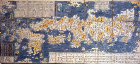
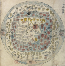
Korean world map, 19th century. Printed and hand-c...
HRM25A14_178
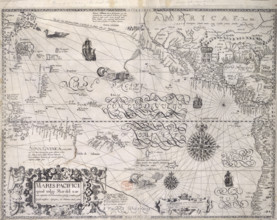
Map of the Pacific Ocean, 1600. Showing the tropic...
HRM25A14_473
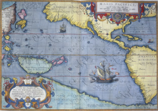
The Pacific Ocean, 1586. 'Maris Pacifici'. A map s...
HRM25A15_421
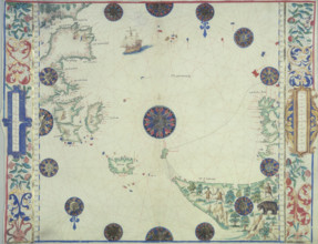
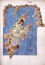
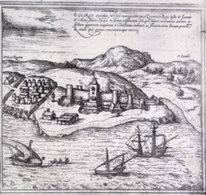
Mitilena (Lesbos), c1485. Mytilene is the capital ...
HRM25A15_391
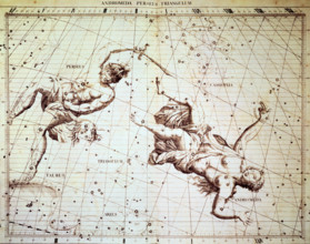
The star constellations Perseus and Andromeda, 172...
HRM25A14_284
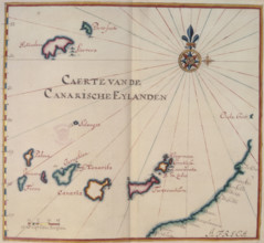
Map of the Canary Islands, 17th century. 'Caerte v...
HRM25A14_497
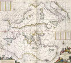
Maps of the Mediterranean, 1682. The upper half is...
HRM25A15_436
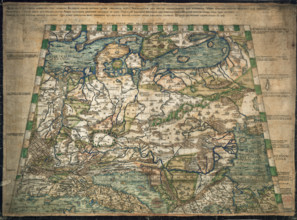
Map of northern and central Europe, 1491. Only six...
HRM25A16_286
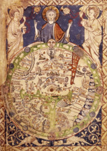
Psalter Map, c1250. A round map of the world, set ...
HRM25A15_435
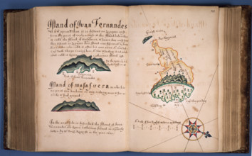
William Hack's atlas of the South Sea of America, ...
HRM25A16_379
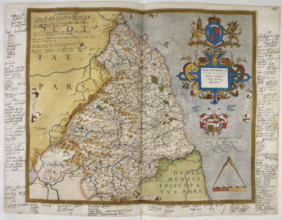
Engraved map of Northumberland, from drawings of C...
HRM25A14_265
Views of the area around Boston, New England, 1773...
HRM25A15_417
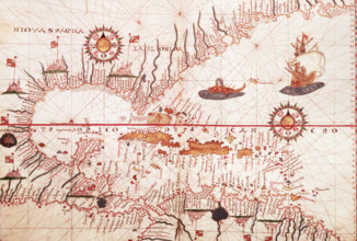
Map of the Caribbean, c1578. Showing 'Niova Spagna...
HRM25A15_430
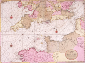
Map of the English Channel, 1693. 'Carte de la Man...
HRM25A15_418
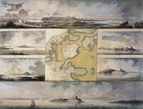
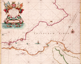
Map of the Firth of Forth, 1689. The first British...
HRM25A15_427
Map of the River Humber and land between Hull and ...
HRM25A15_429
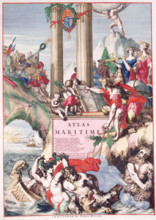
Title page of a maritime atlas, c1693-c1694. This ...
HRM25A14_263
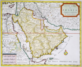
Map of Arabia, 1744. 'Nieuwe Kaart van Arabia. uit...
HRM25A14_169
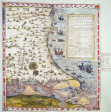
Map of Mina (or Myna), West Africa, 1572. A walled...
HRM25A14_281
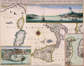
'A Map Containing the Island and Kingdome of Sicil...
HRM25A14_382
Top half of Lord Burghley's chart of the Humber, 1...
HRM25A15_432
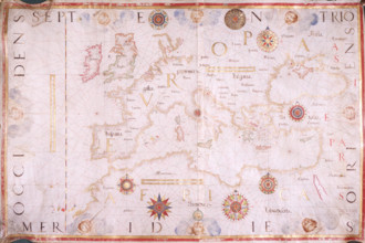
Map of Europe, 1570. The traditional portolan char...
HRM25A14_201
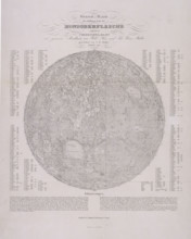
Map of the Moon with tables, 1837.
HRM25A14_271
Map of the Caribbean, 1542. Map showing 'Couba' (C...
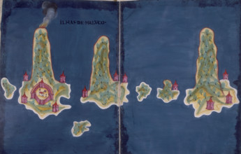
HRM25A14_282
'Ilhas de Maluco', a map of the islands of the Mol...
HRM25A15_332
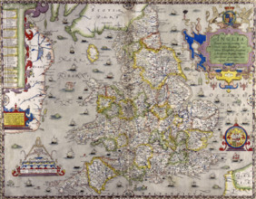
A map of England and Wales, 1583. The various main...
HRM25A13_255
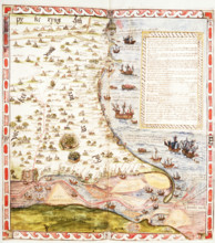
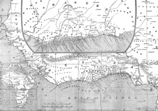
Maps of Africa, Upper Guinea, and the Gold Coast, ...
HRM25A06_134
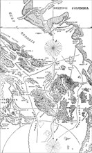
Map of the San Juan Archipelago, with the disputed...
HRM24A61_260
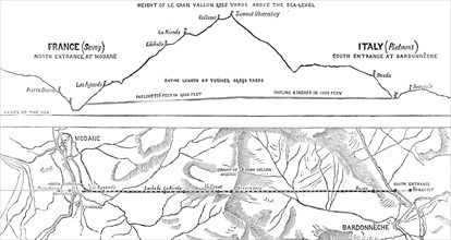
Plan and section of the Mont Cenis Tunnel, 1871. C...
HRM24A48_250
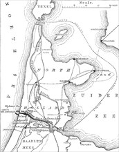
Plan of the Amsterdam Ship Canal, 1870. Creator: U...
HRM24A37_484
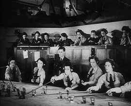
WAAF Plotters Working With Plotting Equipment, 194...
HRM24A39_105
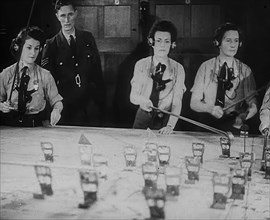
WAAF Plotters Working With Plotting Equipment, 194...

HRM24A39_188
WAAF Plotters Working With Plotting Equipment, 194...
HRM24A48_257
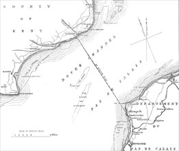
Route of the proposed Channel Railway Ferry, 1870....
HRM24A34_158
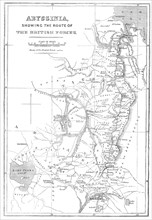
Abyssinia, showing the route of the British forces...
- Page
-
- sur
- 6