Sujet
Map of the central region of the Soudan, 1883. Creator: Unknown.
Légende
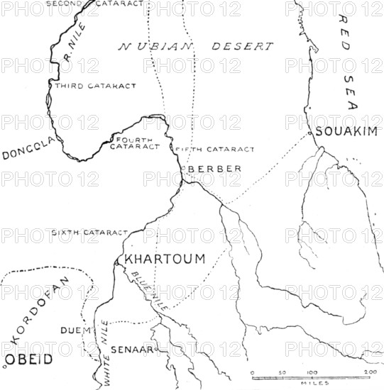
Map of the central region of the Soudan, 1883. 'The Egyptian army of ten thousand men, under command of Major-General Hicks (with the title of Hicks Pasha) sent last February to put down the Mussulman native and Arab insurrection in the Soudan, has been utterly destroyed...it was overwhelmed by at least twenty times its own force, under the leadership of the "Mahdi," and in three days of desperate fighting was cut to pieces... Our Sketch Map this week shows the region around Khartoum, where the remnant of the Egyptian garrison, which may be 2000 or 4000 men, will find it a hard matter to maintain any valid defence...Our Map only shows the central region of the Soudan, comprising Nubia, Dongola and Berber, with Souakim on the Red Sea coast; the important town of Khartoum, its political and commercial capital; and a portion of Kordofan and Sennaar...Though cataracts, or rather rapids, obstruct the navigation of the Nile beyond Egypt, it is possible to march direct to Khartoum, either quitting the river below the Second Cataract and crossing the Nubian desert, by the routes indicated on our Map in dotted lines, to Abou Hamed or Berber; or else keeping up the river to Dongola, and thence crossing the western part of Nubia to Berber or Khartoum'. From "Illustrated London News", 1883.
Crédit
Photo12/Heritage Images/The Print Collector
Notre référence
HRM25A50_392
Model release
NA
Property release
NA
Licence
Droits gérés
Format disponible
11.2Mo (230.3Ko) / 16.7cm x 16.9cm / 1968 x 1998 (300dpi)