Sujet
Seven Years War (1756-1763): Map of capture of Belle Isle (June 1761), 1765. Creator: Jean de Beaurain.
Légende
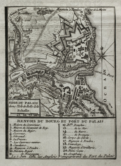
Seven Years War (1756-1763): Map of capture of Belle Isle (June 1761), 1765. The British succeeded in storming the main citadel of the island, located on the Atlantic coast off Brittany, after a second landing led by General Studholme Hodgson and a subsequent six-week siege. Map Published in 1765 by the cartographer Jean de Beaurain (1696-1771) as an illustration of his "Great Map of Germany, with the events that took place during the Seven Years War". French edition, 1765.
Crédit
Photo12/Heritage Images/PRISMA ARCHIVO FOTOGRÁFICO, S.L.
Notre référence
HRM25A40_496
Model release
NA
Property release
NA
Licence
Droits gérés
Format disponible
42.6Mo (2.3Mo) / 28.0cm x 38.2cm / 3307 x 4506 (300dpi)