Légende
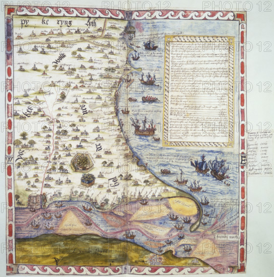
Top half of Lord Burghley's chart of the Humber, 1579. Coloured manuscript plan of the River Humber and North Sea coast from Hull to Scarborough, with marginal notes by Lord Burghley. Settlements and coastal landmarks are identified, and ships are shown off the coast. From Lord Burghley's Atlas.
Date
1560
Crédit
Photo12/Heritage Images/Heritage Art
Notre référence
HRM25A14_382
Model release
NA
Property release
NA
Licence
Droits gérés
Format disponible
50.0Mo (4.9Mo) / 35.2cm x 35.6cm / 4160 x 4199 (300dpi)