Légende
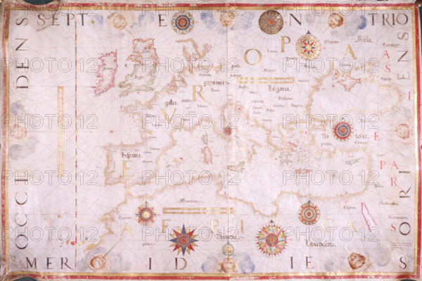
Map of Europe, 1570. The traditional portolan chart - the large, single-sheet, hand-drawn map of the Mediterranean region - still flourished a full century after the advent of map printing. It marked latitude but not longitude, was almost always drawn at a scale of 1:6 million, and lacked any interest in northern Europe. In this example, Britain and Scandinavia are inaccurately mapped, and the Baltic fades into a blank emptiness.
Date
1570
Crédit
Photo12/Heritage Images/Heritage Art
Notre référence
HRM25A15_432
Model release
NA
Property release
NA
Licence
Droits gérés
Format disponible
50.0Mo (3.8Mo) / 43.4cm x 28.9cm / 5122 x 3412 (300dpi)