Légende
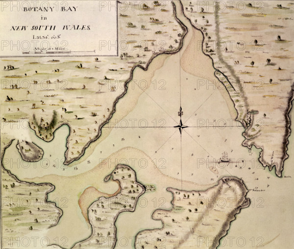
Map of Botany Bay, New South Wales, Australia, 1770. The chart made of Botany Bay during Cook's stay there, drawn probably by Cook himself. Prior to Cook's voyage, the west and south coasts of Australia had been visited by other European explorers, but the east coast was unexplored. Cook first sighted the eastern coast of Australia on 19 April 1770, and landed at Botany Bay, so called because of the large number of previously unknown plants collected there by the expedition's scientists. The bay now forms part of the southern suburbs of Sydney.
Date
1770
Crédit
Photo12/Heritage Images/Heritage Art
Notre référence
HRM25A15_103
Model release
NA
Property release
NA
Licence
Droits gérés
Format disponible
50.7Mo (2.4Mo) / 38.8cm x 32.8cm / 4580 x 3872 (300dpi)