Légende
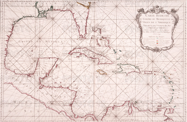
Map of the Gulf of Mexico, 1772. 'Carte Reduite du Golphe du Mexique et des Isles de l'Amerique Pour server aux Vaisseaux do Roy'. (Reduced Map of the Gulf of Mexico and the Islands of America for Use by the King's Vessels). The French had established an official charting programme in the 1680s, a century ahead of the British. Jacques Nicolas Bellin brought French charting to its peak in the years between 1741 and 1772. There are few depth-soundings on this small-scale chart, but the Mexican continental shelf is shown in contour fashion. The Caribbean islands are colour-coded to show their possession by the French, British, Spanish, Dutch or Danish. From Bellin's "Hydrographie Francoise".
Date
1772
Crédit
Photo12/Heritage Images/Heritage Art
Notre référence
HRM25A15_419
Model release
NA
Property release
NA
Licence
Droits gérés
Format disponible
50.0Mo (4.4Mo) / 43.8cm x 28.6cm / 5171 x 3378 (300dpi)