Légende
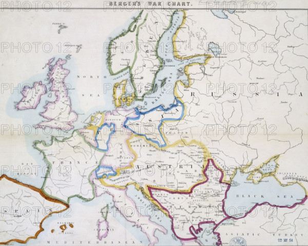
Berger's war chart, 1854. A map of Europe at the time of the Crimean War, including the Baltic and Black Seas, the Danube, the Empires of Russia and Turkey and the surrounding countries.
Date
1854
Crédit
Photo12/Heritage Images/Heritage Art
Notre référence
HRM25A14_267
Model release
NA
Property release
NA
Licence
Droits gérés
Format disponible
50.0Mo (4.9Mo) / 39.6cm x 31.6cm / 4674 x 3738 (300dpi)