Sujet
The Opening of the Baltic Canal: map and section of the canal, 1895. Creator: George Philip & Son Ltd.
Légende
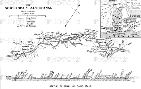
The Opening of the Baltic Canal: map and section of the canal, 1895. North Sea and Baltic Canal, showing ship canal, Eider Canal, railways, roads, ferries and sidings. Inset map shows Denmark, Sweden, and Germany, with the ports of Copenhagen, Kiel, and Hamburg. Illustration from a '...Supplement commemorative of the opening of the Baltic [or Kiel] Canal'. The 98-kilometer-long (61 mile) freshwater canal links the North Sea to the Baltic Sea. It runs through the German state of Schleswig-Holstein, from Brunsbüttel, at the mouth of the Elbe, to Holtenau, on the Kiel Fjord. It was constructed between 1887 and 1895. From "Illustrated London News", 1895.
Crédit
Photo12/Heritage Images/The Print Collector
Notre référence
HRM26A09_105
Model release
NA
Property release
NA
Licence
Droits gérés
Format disponible
23.0Mo (905.4Ko) / 30.1cm x 19.1cm / 3558 x 2255 (300dpi)