Sujet
Map of Louisbourg, Nova Scotia, Canada, 1765. Creator: Jean de Beaurain.
Légende
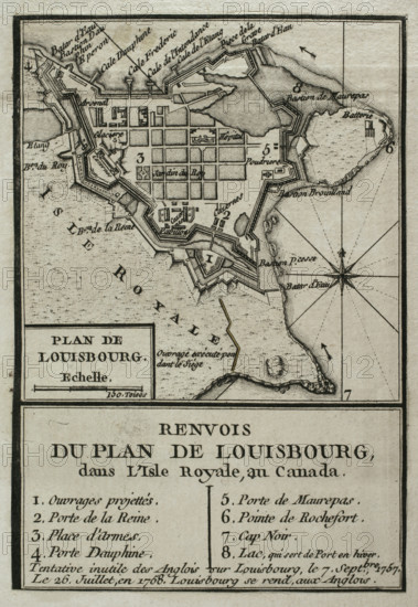
Map of Louisbourg, Nova Scotia, Canada, 1765. It depicts the siege of the French fortress by the British in 1758. Published in 1765 by the cartographer Jean de Beaurain (1696-1771) as an illustration for his "Great Map of Germany, with the events that took place during the Seven Years' War". French edition, 1765. Engraving.
Crédit
Photo12/Heritage Images/PRISMA ARCHIVO FOTOGRÁFICO, S.L.
Notre référence
HRM25A41_022
Model release
NA
Property release
NA
Licence
Droits gérés
Format disponible
44.5Mo (3.3Mo) / 27.7cm x 40.2cm / 3274 x 4752 (300dpi)