même sujet
Hrmcartes12
Légende
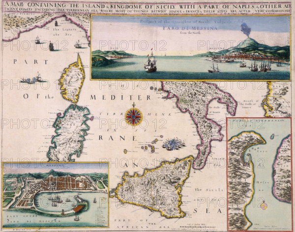
'A Map Containing the Island and Kingdome of Sicily with a Part of Naples', 1676. '...& Other Adjacent Coasts including the Tyrrhenean Sea, where most things betwixt Spaine & France & their Alyes are acted; Prospect of the Straights of Sicily vulgarly call'd Faro di Messina, from the North'. The map also shows Corsica and Sardinia, and features a view and a larger scale map of the Straits of Messina, as well as a plan of the port of Messina itself.
Date
1675
Crédit
Photo12/Heritage Images/Heritage Art
Notre référence
HRM25A14_281
Model release
NA
Property release
NA
Licence
Droits gérés
Format disponible
49.9Mo (7.9Mo) / 39.8cm x 31.4cm / 4700 x 3712 (300dpi)