Légende
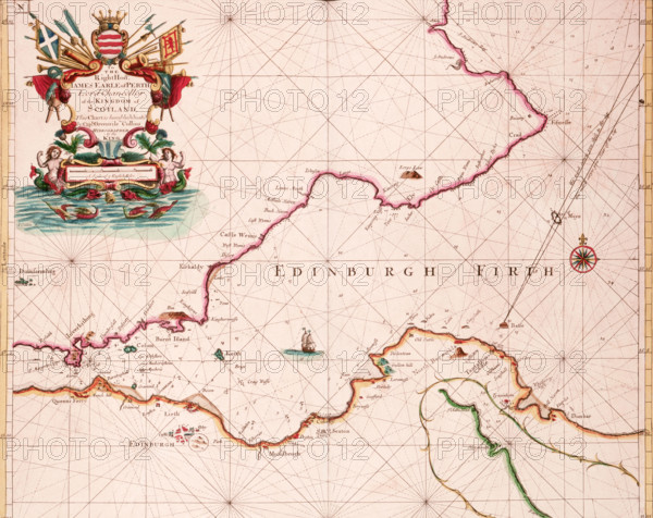
Map of the Firth of Forth, 1689. The first British charts of British waters were published only towards the end of the 17th century, drawn from original surveys commissioned by the Admiralty. Before this date the British Navy and the merchant fleet were dependent on Dutch charts. Greenvile Collins' charts, such as this one, were a major advance, but they lacked a clear scientific basis. They show no latitude or longitude, and were not tied to any true topographic survey. He produced 47 charts, which covered all but the western coasts of Scotland and Ireland, and despite their shortcomings, they remained in use until the late 18th century.
Date
1689
Crédit
Photo12/Heritage Images/Heritage Art
Notre référence
HRM25A15_418
Model release
NA
Property release
NA
Licence
Droits gérés
Format disponible
50.0Mo (4.0Mo) / 39.7cm x 31.5cm / 4690 x 3726 (300dpi)