même sujet
Hrmcartes12
Légende
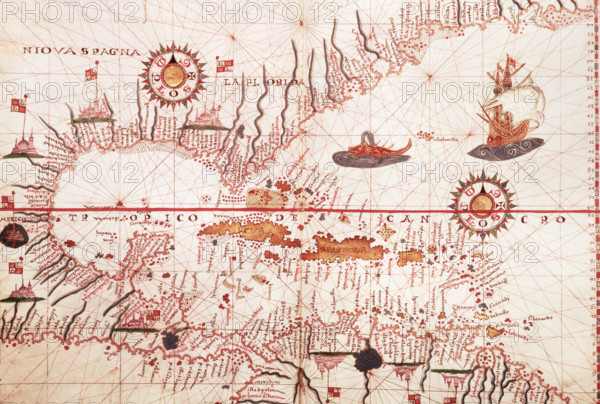
Map of the Caribbean, c1578. Showing 'Niova Spagna' ie New Spain - land conquered by the Spaniards: Hispaniola, Cuba, Florida, and the north coast of South America. A prolific Spanish chartmaker working in Messina, Sicily, Martines produced scores of highly-finished sea atlases between 1550 and 1590. It is clear from the high degree of inland detail shown, that these maps were intended to function as world atlases rather than as strictly navigational charts.
Date
1578
Crédit
Photo12/Heritage Images/Heritage Art
Notre référence
HRM25A15_417
Model release
NA
Property release
NA
Licence
Droits gérés
Format disponible
50.0Mo (3.0Mo) / 43.1cm x 29.1cm / 5089 x 3433 (300dpi)