Légende
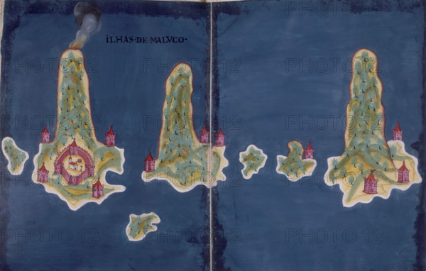
'Ilhas de Maluco', a map of the islands of the Moluccas, Indonesia, 1646. Showing from left to right the islands of Hiri, Ternate, Maitara, Tidore, Mare and Makian. The perspective emphasises the height of the volcanoes which rise from the sea to form each of the islands. From "Livro do Estado da India Oriental", by Pedro Barreto de Resende.
Date
1646
Crédit
Photo12/Heritage Images/Heritage Art
Notre référence
HRM25A14_282
Model release
NA
Property release
NA
Licence
Droits gérés
Format disponible
49.9Mo (3.5Mo) / 44.3cm x 28.2cm / 5235 x 3333 (300dpi)