Légende
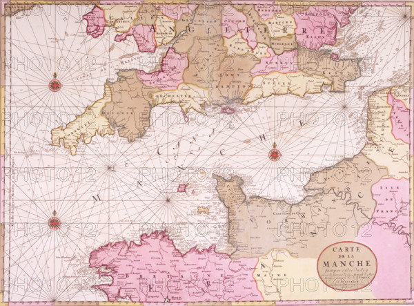
Map of the English Channel, 1693. 'Carte de la Manche'. During the reign of Louis XIV, the French initiated a state-sponsored programme to map France and its coastal waters, and by the 1690s they possessed the most accurate charts in Europe. They were tied to precise topographical surveys, were astronomically fixed, and showed an unorecedented amount of hydrographic data. The first great collection of French charts, "Le Neptune Francois", was published in Paris in 1693 under royal privilege by Charles Pene, but it was immediately pirated by the Amsterdam publisher Pieter Mortier, as seen here.
Date
1693
Crédit
Photo12/Heritage Images/Heritage Art
Notre référence
HRM25A15_430
Model release
NA
Property release
NA
Licence
Droits gérés
Format disponible
50.0Mo (4.2Mo) / 41.2cm x 30.4cm / 4863 x 3593 (300dpi)