Sujet
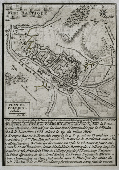
Seven Years War (1756-1763): Map of the Siege of Colberg (from 3 to 29 October 1758), 1765. Creator: Jean de Beaurain.
Légende
Seven Years War (1756-1763): Map of the Siege of Colberg (from 3 to 29 October 1758), 1765. Prussian city in Brandenburg, in Pomerania. Russian troops under Palmenbach tried unsuccessfully to seize the town. Published in 1765 by the cartographer Jean de Beaurain (1696-1771) as an illustration of his "Great Map of Germany, with the events that took place during the Seven Years War". French edition, 1765.
Crédit
Photo12/Heritage Images/PRISMA ARCHIVO FOTOGRÁFICO, S.L.
Notre référence
HRM25A41_016
Model release
NA
Property release
NA
Licence
Droits gérés
Format disponible
44.5Mo (2.8Mo) / 28.0cm x 39.8cm / 3307 x 4703 (300dpi)