Légende
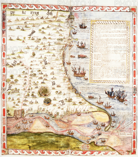
Map of the River Humber and land between Hull and Scarborough, 1579. Coloured manuscript plan of the River Humber and North Sea coast from Hull to Scarborough, with marginal notes by Lord Burghley. With particulars of the tides and a list of 'havens and Crickes on ye Northsyde of Humbre, pertening to ye Custom howse of Hull'. From Lord Burghley's Atlas.
Date
1579
Crédit
Photo12/Heritage Images/Heritage Art
Notre référence
HRM25A15_427
Model release
NA
Property release
NA
Licence
Droits gérés
Format disponible
50.0Mo (4.2Mo) / 33.3cm x 37.7cm / 3928 x 4447 (300dpi)