Légende
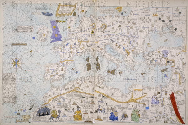
Map of Europe, North Africa and the Mediterranean, c1842-c1853. From the atlas of the Visconde of Santarem. Santarem's objective was to publish in fine lithographic reproduction the most significant early maps and charts to be found in European libraries and archives. The original of this Catalan portolan chart was probably produced in the 14th century.
Date
1842
Crédit
Photo12/Heritage Images/Heritage Art
Notre référence
HRM25A14_482
Model release
NA
Property release
NA
Licence
Droits gérés
Format disponible
50.0Mo (6.7Mo) / 43.3cm x 28.9cm / 5114 x 3414 (300dpi)