Légende
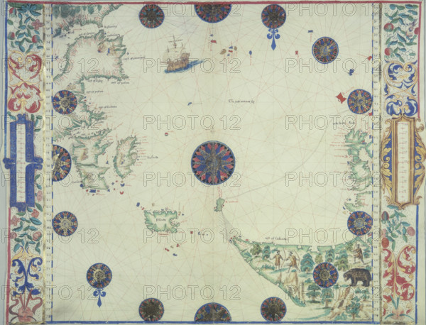
Chart of the Atlantic Ocean, c1535-1542. The map is 'upside down' to western eyes. At bottom right is the coast of Labrador, peopled by Indians with bows and arrows, and a bear. The island near the centre of the map is Iceland, and on the left are the British Isles and the north coast of France, above that Spain and part of North Africa. From the "Boke of Idrography" (The Rotz Atlas) by John Rotz.
Date
1542
Crédit
Photo12/Heritage Images/Heritage Art
Notre référence
HRM25A14_492
Model release
NA
Property release
NA
Licence
Droits gérés
Format disponible
50.0Mo (3.1Mo) / 40.5cm x 30.9cm / 4781 x 3655 (300dpi)