Légende
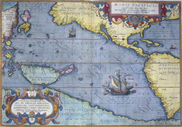
The Pacific Ocean, 1586. 'Maris Pacifici'. A map showing North and South America, China, New Guinea, and other islands. It also shows the projected coastline of Terra Australis, the then undiscovered Antarctic continent.
Date
1586
Crédit
Photo12/Heritage Images/Heritage Art
Notre référence
HRM25A14_473
Model release
NA
Property release
NA
Licence
Droits gérés
Format disponible
49.9Mo (6.3Mo) / 42.2cm x 29.6cm / 4989 x 3496 (300dpi)