Légende
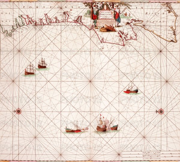
Map of the Atlantic coast of Portugal, 1682. 'Pascaart van de Kust van Portugal, Van C. de Finisterre tot aen C. de S. Vincente'. (Passport of the Coast of Portugal, From C. de Finisterre to C. de S. Vincente). Before the advent of scientific surveying, this Dutch type of coastal chart, which enlarged harbours and river mouths, remained dominant. Equally long-lived was the image of the Turkish ships which made the Mediterranean a place of danger, such as those depicted towards the bottom of the map, engaged in battle with a European vessel. Death or a life of slavery in the Turkish galleys was the fate which overtook thousands of unfortunate seamen. By the late 17th century, the British, French and Dutch were making determined efforts to reduce the power of the Turkish fleet and to clear the sea of corsairs.
Date
1682
Crédit
Photo12/Heritage Images/Heritage Art
Notre référence
HRM25A15_420
Model release
NA
Property release
NA
Licence
Droits gérés
Format disponible
50.1Mo (4.4Mo) / 37.3cm x 33.6cm / 4411 x 3970 (300dpi)