Sujet
Martinique, 1762 (1765). Creator: Jean de Beaurain.
Légende
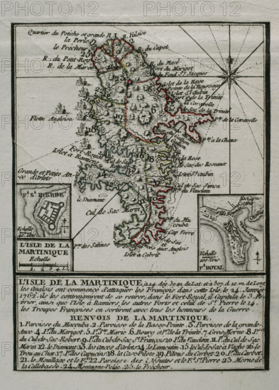
Martinique, 1762 (1765). Island captured by the British from the French during the Seven Years War (1756-1763), remaining in their possession from 1762 to 1763. The British began attacking the French on the island on 24 January 1762, forcing them to retreat to the capital, Fort-Royal. The French capitulated on 3 February. On 12 February, the whole island was under British control. Map published in 1765 by the cartographer Jean de Beaurain (1696-1771) as an illustration of his "Great Map of Germany, with the events that took place during the Seven Years War". Allied army in red and the French army in blue. French edition, 1765.
Crédit
Photo12/Heritage Images/PRISMA ARCHIVO FOTOGRÁFICO, S.L.
Notre référence
HRM25A41_026
Model release
NA
Property release
NA
Licence
Droits gérés
Format disponible
47.0Mo (3.5Mo) / 29.0cm x 40.6cm / 3425 x 4792 (300dpi)