Sujet
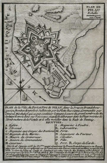
Seven Years War (1756-1763): Map of the fortress of Pillau, on the Baltic Sea, 1765. Creator: Jean de Beaurain.
Légende
Seven Years War (1756-1763): Map of the fortress of Pillau, on the Baltic Sea, 1765. The Russian army was bombarding the fortress during 1757 and 1758, altough was forced to cease it attacks because of an excessive incidence of disease. Despite this, the Prussians abandoned the fortress in early 1758, and remained in Russian hands during the duration of the war. Published in 1765 by the cartographer Jean de Beaurain (1696-1771) as an illustration of his "Great Map of Germany, with the events that took place during the Seven Years War". French edition, 1765.
Crédit
Photo12/Heritage Images/PRISMA ARCHIVO FOTOGRÁFICO, S.L.
Notre référence
HRM25A40_495
Model release
NA
Property release
NA
Licence
Droits gérés
Format disponible
47.5Mo (3.0Mo) / 28.0cm x 42.5cm / 3307 x 5018 (300dpi)