Sujet
Seven Years War (1756-1763): Map of the Russian bombardment of Memel, 1757 (1765). Creator: Jean de Beaurain.
Légende
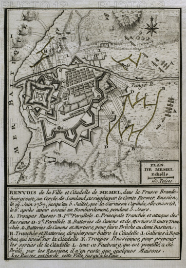
Seven Years War (1756-1763): Map of the Russian bombardment of Memel, 1757 (1765). On June 19, 1757 the Russian army, commanded by Field Marshal Stepan Fyodorovich Apraksin, besieged the town to seize one of the most strongest fortresses in Prussia. After five days of severe artillery fire, Russian troops succeeded in their assault. The garrison capitulated on 6 July and and was taken by the Russians for the rest of the war. Memel was used by the Russians as a base from which to invade East Prussia. Published in 1765 by the cartographer Jean de Beaurain (1696-1771) as an illustration of his "Great Map of Germany, with the events that took place during the Seven Years War". French edition, 1765.
Crédit
Photo12/Heritage Images/PRISMA ARCHIVO FOTOGRÁFICO, S.L.
Notre référence
HRM25A41_029
Model release
NA
Property release
NA
Licence
Droits gérés
Format disponible
48.3Mo (4.3Mo) / 29.0cm x 41.7cm / 3425 x 4928 (300dpi)