1003 résultats pour : diagrams
- Page
-
- sur
- 11
Connectez-vous pour plus de résultats
HRM26A23_062
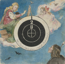
Decorated target, 1878. Creator: Wilhelm August Th...
HRM26A15_327
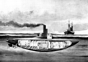
The Spanish-American War: America's new armoured t...
HRM26A16_059
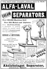
Advertisement for Alfa-Laval Cream Separators, 189...
HRM26A05_490
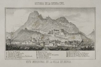
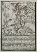
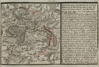
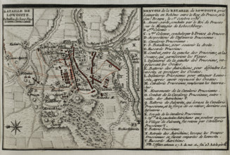
First Carlist War, (1833-1840): Southern view of t...
HRM26A07_438
Our Near Neighbour, Mars: Fig. 7: the "Channels" o...
HRM26A07_435
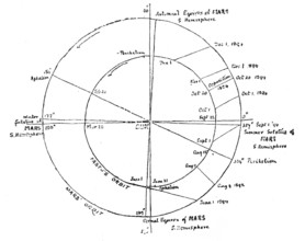
Our Near Neighbour, Mars: Fig. 4: orbits of Mars a...
HRM25A56_306
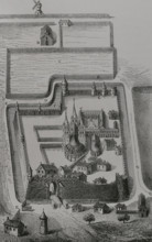
Abbey of Saint-Germain-des-Prés, Paris, France, 18...

HRM25A50_426
Mappin and Webb's Spoons & Forks, 1883. Creator: U...
HRM25A50_202
Map of the Balloon Voyage from Hastings to Boulogn...
HRM25A47_019
The effects of scurvy, February 1841. Creator: Hen...

HRM25A50_238
Advertisement for Benson's watches, 1883. Creator:...
HRM25A33_397
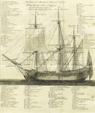
Elevation of a Merchant-Ship with all her Masts, Y...
HRM25A41_012
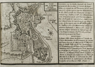
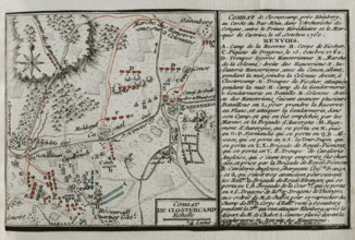
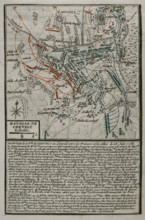
Seven Years War (1756-1763): Map of Cassel, 1757-1...
HRM25A41_021
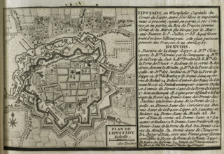
Map of Lippstadt (Germany), 1757-1758 (1765). Crea...
HRM25A33_407
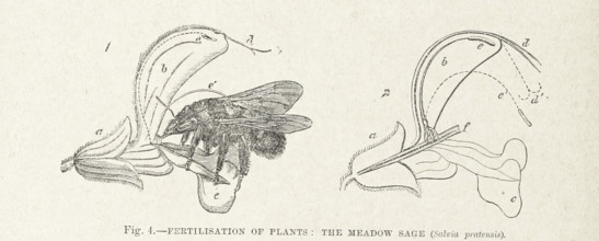
Fertilisation of Plants: the Meadow Sage (Salvia p...
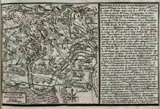
HRM25A41_011
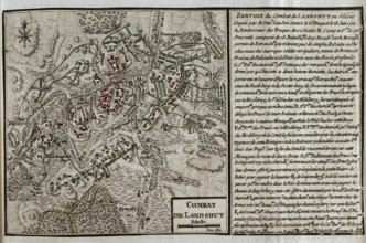
Map of the Battle of Landeshut (June 23, 1760), Se...
HRM25A41_022
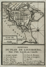
Map of Louisbourg, Nova Scotia, Canada, 1765. Cre...
HRM25A41_010
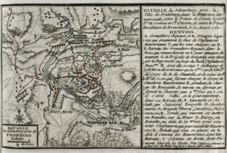
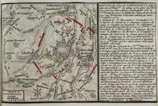
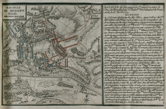
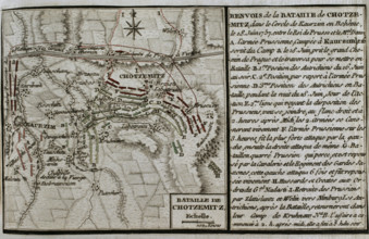
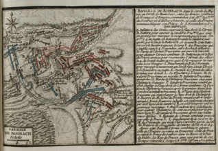
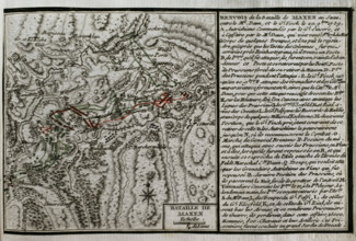
Seven Years War (1756-1763): Map of the Battle of ...
HRM25A41_019
Seven Years War (1756-1763): Battle of Kunersdorf ...
HRM25A41_037
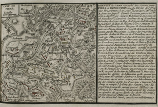
Seven Years War (1756-1763): Map of the encampment...
HRM25A41_048
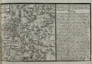
Seven Years War (1756-1763): Third Silesian War - ...
HRM25A41_210
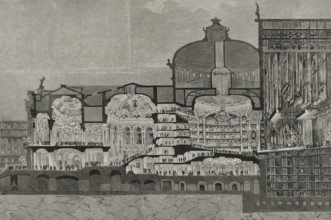
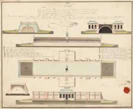
Longitudinal section of the Theatre of Palais Garn...
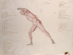
HRM25A33_423
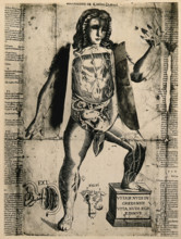
Myologic structure of the 'Borghese Gladiator' sta...
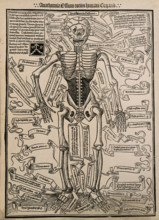
HRM25A37_332
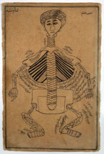
A skeleton, seen from the front, with labels givin...

HRM25A37_442
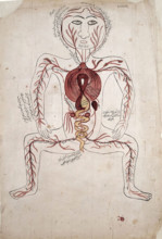
The arteries of the human body with a foetus in th...
HRM25A41_009
Seven Years War (1756-1763): Map of the Battle of ...
HRM25A41_020
Seven Years War (1756-1763): Third Silesian War - ...
HRM25A41_038
Seven Years War (1756-1763): Map of the Battle of ...
HRM25A41_047
Seven Years War (1756-1763): Third Silesian War - ...
HRM25A35_468
Buildings and plant for producing saltpetre, 1806....
HRM25A37_333
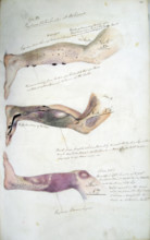
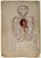
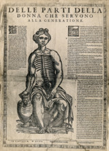
A seated female figure with a dissected abdomen, c...
HRM25A37_443
The viscera and the arterial system, (between 1800...
HRM25A38_049
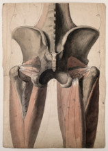
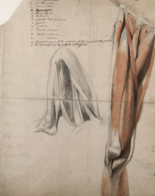
The muscles and bones of the pelvis and thighs, 18...
HRM25A40_498
Seven Years War (1756-1763): Third Silesian War - ...
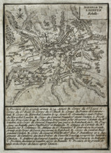
HRM25A41_007
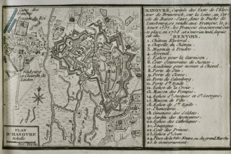
Map of Hannover, 1757-1758 (1765). Creator: Jean ...
HRM25A41_016
Seven Years War (1756-1763): Map of the Siege of C...
HRM25A41_025
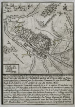
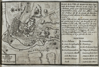
Seven Years War (1756-1763): Map of Marburg and si...
HRM25A37_444
The viscera and the venous system, (between 1800 a...
HRM25A40_497
Seven Years War (1756-1763): Map of the Battle of ...
HRM25A41_008
Seven Years War (1756-1763): Map of the siege of F...
HRM25A41_015
Seven Years War (1756-1763): Map of the Battle of ...
HRM25A41_026
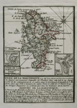
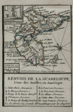
Martinique, 1762 (1765). Creator: Jean de Beaurai...
HRM25A41_316
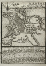
Spanish-American War (1898): entrance and bay of S...
HRM25A43_378
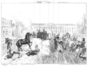
Assassination of Alexander II.: sketch showing exa...
HRM25A37_445
The viscera and the venous system, (between 1800 a...
HRM25A38_040
The muscles and tendons of the leg: two figures, i...
HRM25A41_014
Seven Years War (1756-1763): Map of the Battle of ...
HRM25A41_023
Seven Years War (1756-1763): Map of the Battle of ...
HRM25A42_411
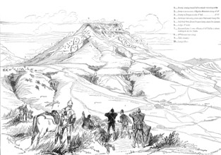
The Transvaal War: sketch plan of the Battle of Ma...
HRM25A33_410
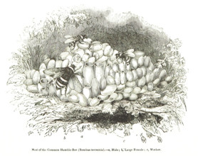
Nest of the Common Humble-Bee (Bombus terrestris),...
HRM25A37_446
Bones of the human body, (between 1800 and 1899?)....
HRM25A41_013
Seven Years War (1756-1763): Map of the Battle of ...
HRM25A41_024
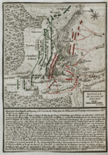
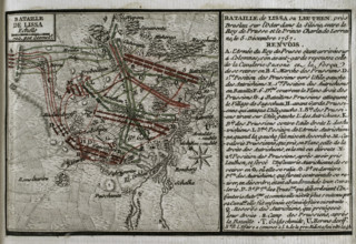
Seven Years War (1756-1763): Battle of Leuthen (5t...
HRM25A43_288
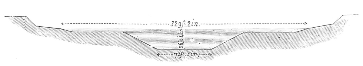
Transverse section of the Suez Canal, 1883. Creato...
HRM25A35_500
A female flap anatomy fugitive sheet, with layered...
HRM25A37_113
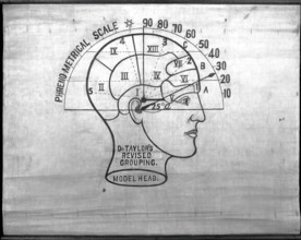
Phrenology: the human and animal brain, the locati...
HRM25A37_447
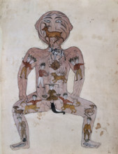
A fugitive sheet of a seated female figure, her ha...
HRM25A40_494
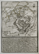
Seven Years War (1756-1763): Map of the Siege of A...
HRM25A41_031
Seven Years War (1756-1763): Map of the Battle of ...
HRM25A41_042
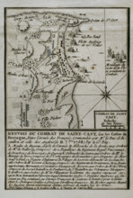
Seven Years War (1756-1763): Battle of Saint-Cast ...
HRM25A41_049
Seven Years War (1756-1763): Map of the Battle of ...
HRM25A41_004
Seven Years War (1756-1763): Map of the Combat of ...
HRM25A41_032
Seven Years War (1756-1763): Map of Mittel Peile, ...
HRM25A41_041
Seven Years War (1756-1763): Map of the Battle of ...
HRM25A41_050
Seven Years War (1756-1763): Map of the Battle of ...
HRM25A40_496
Seven Years War (1756-1763): Map of capture of Bel...
HRM25A41_005
Seven Years War (1756-1763): Map of the Battle of ...
HRM25A41_018
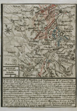
Seven Years War (1756-1763): Plan of the Battle of...
HRM25A41_027
Seven Years War (1756-1763): Third Silesian War - ...
HRM25A41_029
Seven Years War (1756-1763): Map of the Russian bo...
HRM25A41_040
Seven Years War (1756-1763): Map of the Battle of ...
HRM25A41_051
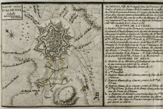
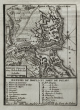
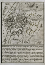
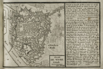
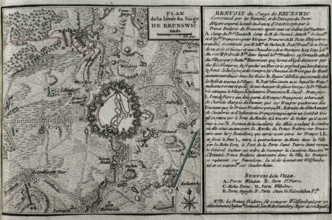
Plan of Wesel and its citadel, North Rhine-Westpha...
HRM25A43_327
The International Fisheries Exhibition, 1883. Crea...
HRM25A43_393
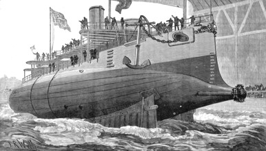
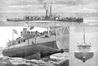
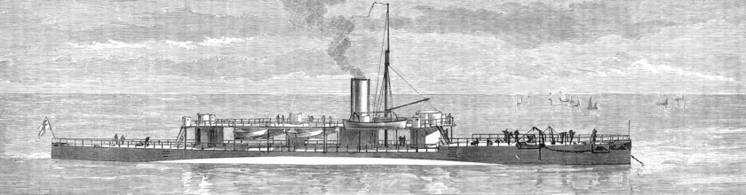
Launch of H.M.S. Polyphemus, new torpedo ram, at C...
HRM25A35_470
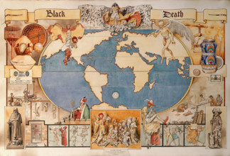
Black Death - pictorial diagram..., late 19th-earl...
HRM25A40_495
Seven Years War (1756-1763): Map of the fortress o...
HRM25A41_006
Seven Years War (1756-1763): Taking of the island ...
HRM25A41_017
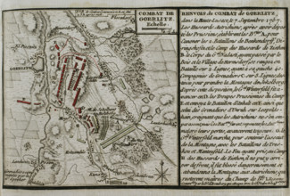
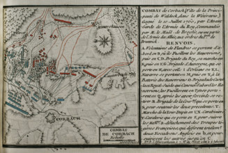
Seven Years War (1756-1763): Map of Battle of Corb...
HRM25A41_028
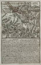
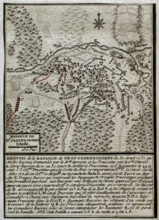
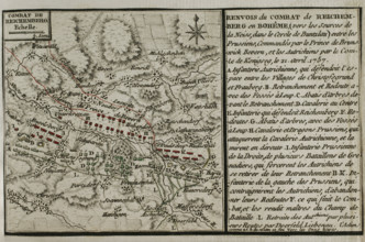
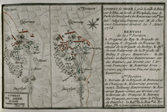
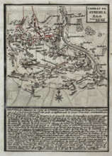
Seven Years War (1756-1763): Combat of Mehr (Augus...
HRM25A41_030
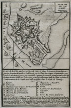
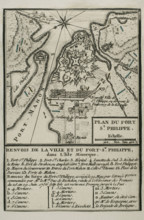
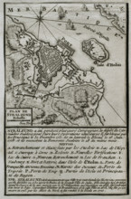
Map of Fort of St Philip (Castle of San Felipe), M...
HRM25A41_039
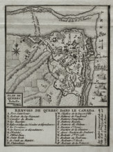
Seven Years War (1756-1763): Map of Quebec, Canada...
HRM25A41_052
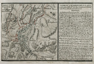
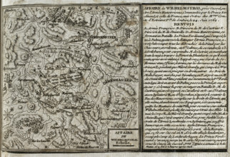
Seven Years War (1756-1763): Battle of Wilhelmstha...
HRM25A43_394
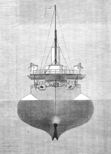
Bow view, showing hull below water-line, 1881. Cre...
HRM25A35_218
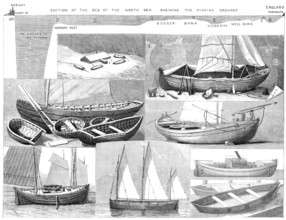
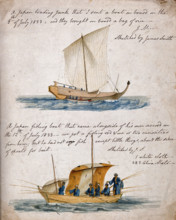
Ship-building: two types of Japanese boat, 1833. C...
HRM25A37_413
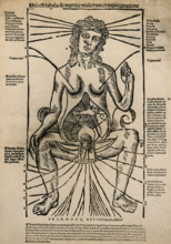
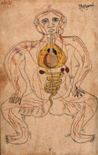
The zodiac man, (between 1800 and 1899?). Creator:...
HRM25A37_424
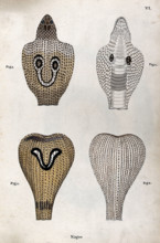
Two poisonous snakes (Indian cobras): four figures...
HRM25A40_499
Seven Years War (1756-1763): Map of the rising of ...
HRM25A41_035
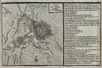
Map of the siege of the town of Neisse by General ...
HRM25A41_046
Seven Years War (1756-1763): Third Silesian War - ...
HRM25A41_053
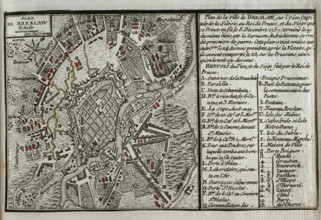
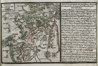
Seven Years War (1756-1763): Map of Breslau and th...
HRM25A43_391
Launch of H.M.S. Polyphemus at Chatham Dockyard, 1...
HRM25A37_038
Richard Bright, c1850s. Creator: Maull & Polyblank...
HRM25A40_500
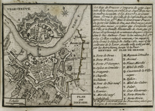
Seven Years War (1756-1763): Map of Dresden, 1760 ...
HRM25A41_036
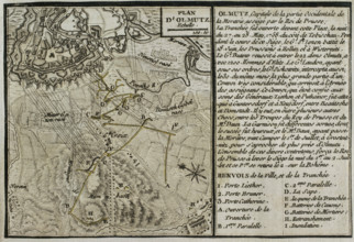
Seven Years War (1756-1763): Map of the Siege of O...
HRM25A41_045
Seven Years War (1756-1763): Pomeranian War - Map ...
HRM25A41_054
Seven Years War (1756-1763): Third Silesian War - ...
HRM25A42_132
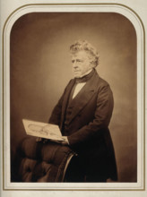
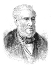
The late Professor Tennant, 1881. Creator: Unknown...
HRM25A43_392
H.M.S. Polyphemus, new torpedo ram, 1881. Creator:...

HRM25A36_182
Louis Cobbett, 1907. Creator: Unknown.
HRM25A41_001
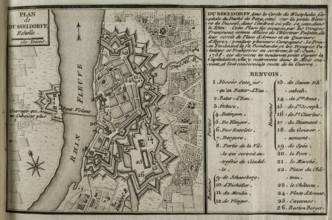
Map of Dusseldorf, 1758 (1765). Creator: Jean de B...
- Page
-
- sur
- 11