Sujet
Seven Years War (1756-1763): Map of the Combat of Görlitz (September 7, 1757), 1765. Creator: Jean de Beaurain.
Légende
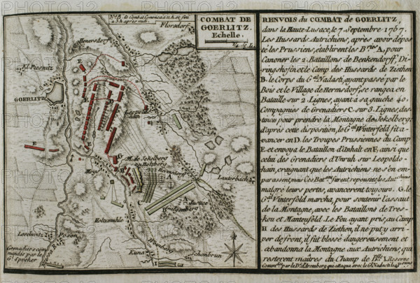
Seven Years War (1756-1763): Map of the Combat of Görlitz (September 7, 1757), 1765. Episode that took place during the Battle of Moys, as part of the Third Silesian War. A Prussian army, commanded by Hans Karl Von Winterfeldt, was defeated by Austrian forces led by Marshal Daun. The entire Prussian corps surrendered to the Austrians. Published in 1765 by the cartographer Jean de Beaurain (1696-1771) as an illustration of his "Great Map of Germany, with the events that took place during the Seven Years War". French edition, 1765.
Crédit
Photo12/Heritage Images/PRISMA ARCHIVO FOTOGRÁFICO, S.L.
Notre référence
HRM25A41_004
Model release
NA
Property release
NA
Licence
Droits gérés
Format disponible
45.4Mo (2.9Mo) / 41.0cm x 27.7cm / 4843 x 3277 (300dpi)