Sujet
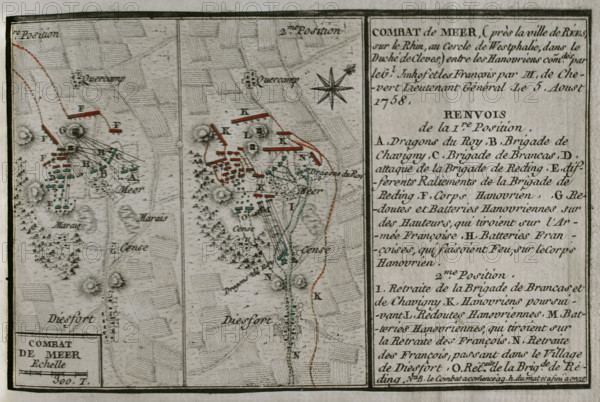
Seven Years War (1756-1763): Combat of Mehr (August 5, 1758), 1765. Creator: Jean de Beaurain.
Légende
Seven Years War (1756-1763): Combat of Mehr (August 5, 1758), 1765. Near Rees (Westphalia), between the allied forces of Hanoverians, commanded by General Imhoff, and the French, led by Lieutenant General de Chevert. Map Published in 1765 by the cartographer Jean de Beaurain (1696-1771) as an illustration of his "Great Map of Germany, with the events that took place during the Seven Years War". Allied army in red and the French army in blue. French edition, 1765.
Crédit
Photo12/Heritage Images/PRISMA ARCHIVO FOTOGRÁFICO, S.L.
Notre référence
HRM25A41_028
Model release
NA
Property release
NA
Licence
Droits gérés
Format disponible
40.6Mo (2.8Mo) / 39.0cm x 26.1cm / 4604 x 3085 (300dpi)