Sujet
Seven Years War (1756-1763): Map of the Battle of Johannisberg, 1762 (August 30, 1762), 1765. Creator: Jean de Beaurain.
Légende
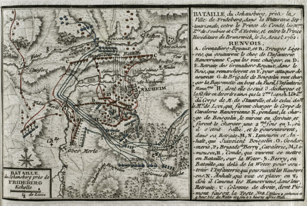
Seven Years War (1756-1763): Map of the Battle of Johannisberg, 1762 (August 30, 1762), 1765. 'Bataille du Johansberg près de Frideberg'. French forces led by Louis Joseph, Prince of Conde, defeated Hanoverian and British army under the command of Duke Ferdinand of Brunswick. Published in 1765 by the cartographer Jean de Beaurain (1696-1771) as an illustration of his "Great Map of Germany, with the events that took place during the Seven Years War". Allied army in red and the French army in blue. French edition, 1765.
Crédit
Photo12/Heritage Images/PRISMA ARCHIVO FOTOGRÁFICO, S.L.
Notre référence
HRM25A41_010
Model release
NA
Property release
NA
Licence
Droits gérés
Format disponible
42.1Mo (2.8Mo) / 39.5cm x 26.7cm / 4669 x 3148 (300dpi)