Sujet
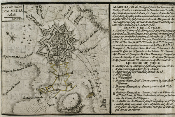
Seven Years War (1756-1763): Map of the Siege of Almeida (16 to 25 August 1762), 1765. Creator: Jean de Beaurain.
Légende
Seven Years War (1756-1763): Map of the Siege of Almeida (16 to 25 August 1762), 1765. Spanish troops led by Pedro Pablo Abarca de Bolea, Count of Aranda, besieged and took the Portuguese city during the conflict. Published in 1765 by the cartographer Jean de Beaurain (1696-1771) as an illustration of his "Great Map of Germany, with the events that took place during the Seven Years War". French edition, 1765.
Crédit
Photo12/Heritage Images/PRISMA ARCHIVO FOTOGRÁFICO, S.L.
Notre référence
HRM25A40_494
Model release
NA
Property release
NA
Licence
Droits gérés
Format disponible
47.3Mo (3.2Mo) / 42.0cm x 28.2cm / 4961 x 3334 (300dpi)