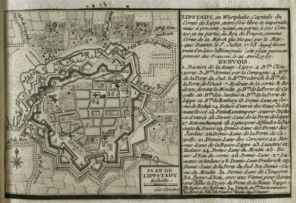
Sujet
Map of Lippstadt (Germany), 1757-1758 (1765). Creator: Jean de Beaurain.
Légende
Map of Lippstadt (Germany), 1757-1758 (1765). Published in 1765 by the cartographer Jean de Beaurain (1696-1771) as an illustration of his "Great Map of Germany, with the events that took place during the Seven Years War". French edition, 1765.
Crédit
Photo12/Heritage Images/PRISMA ARCHIVO FOTOGRÁFICO, S.L.
Notre référence
HRM25A41_021
Model release
NA
Property release
NA
Licence
Droits gérés
Format disponible
48.4Mo (4.2Mo) / 42.0cm x 28.8cm / 4961 x 3407 (300dpi)