Sujet
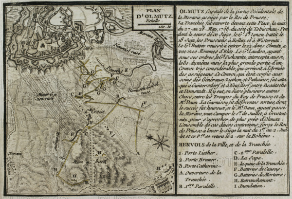
Seven Years War (1756-1763): Map of the Siege of Olmutz (27th May-1st July 1758), 1765. Creator: Jean de Beaurain.
Légende
Seven Years War (1756-1763): Map of the Siege of Olmutz (27th May-1st July 1758), 1765. The Prussian army, commanded by Frederick the Great, besieged the city of Olmutz in Moravia, which was under Austrian Habsburg control. The resistance of the Austrian army, led by Ernst Dietrich Marschall, forced the Prussians to abandon the siege and retreat from Moravia. Published in 1765 by the cartographer Jean de Beaurain (1696-1771) as an illustration of his "Great Map of Germany, with the events that took place during the Seven Years War". French edition, 1765.
Crédit
Photo12/Heritage Images/PRISMA ARCHIVO FOTOGRÁFICO, S.L.
Notre référence
HRM25A41_036
Model release
NA
Property release
NA
Licence
Droits gérés
Format disponible
48.1Mo (4.4Mo) / 42.0cm x 28.7cm / 4961 x 3389 (300dpi)