Sujet
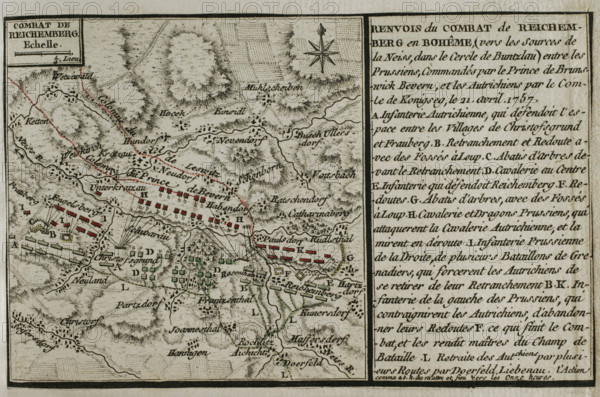
Seven Years War (1756-1763): Map of the Battle of Reichenberg (April 21, 1757), 1765. Creator: Jean de Beaurain.
Légende
Seven Years War (1756-1763): Map of the Battle of Reichenberg (April 21, 1757), 1765. The Prussian army, under the command of August Wilhelm, Duke of Brunswick-Bevern (1715-1781), defeated the Austrian army led by Christian Moritz Graf Königsegg und Rothenfels (1705-1778). Published in 1765 by the cartographer Jean de Beaurain (1696-1771) as an illustration of his "Great Map of Germany, with the events that took place during the Seven Years War". French edition, 1765.
Crédit
Photo12/Heritage Images/PRISMA ARCHIVO FOTOGRÁFICO, S.L.
Notre référence
HRM25A41_040
Model release
NA
Property release
NA
Licence
Droits gérés
Format disponible
43.6Mo (3.7Mo) / 40.6cm x 26.9cm / 4797 x 3177 (300dpi)