Sujet
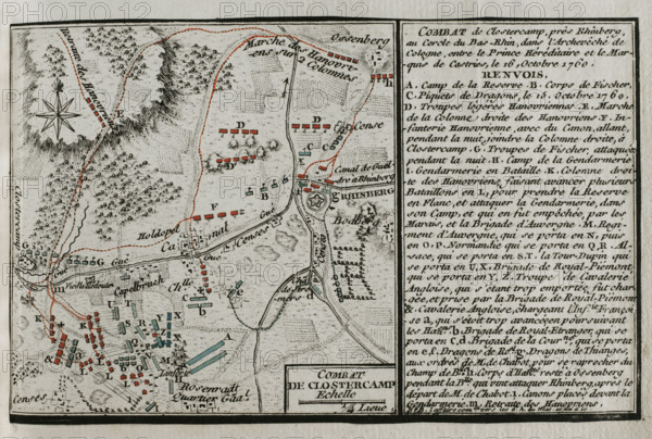
Seven Years War (1756-1763): Map of the Battle of Klostercamp (October 16, 1760), 1765. Creator: Jean de Beaurain.
Légende
Seven Years War (1756-1763): Map of the Battle of Klostercamp (October 16, 1760), 1765. Duke Ferdinand of Brunswick, leading the allied army,had to abandon the battlefield in front of a French army commanded by the Lieutenant-General Marquis de Castries (Charles Eugene Gabriel de La Croix de Castries). Published in 1765 by the cartographer Jean de Beaurain (1696-1771) as an illustration of his "Great Map of Germany, with the events that took place during the Seven Years War". Allied army in red and the French army in blue. French edition, 1765.
Crédit
Photo12/Heritage Images/PRISMA ARCHIVO FOTOGRÁFICO, S.L.
Notre référence
HRM25A41_014
Model release
NA
Property release
NA
Licence
Droits gérés
Format disponible
45.2Mo (3.8Mo) / 41.0cm x 27.6cm / 4843 x 3262 (300dpi)