Sujet
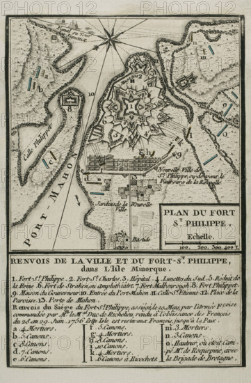
Map of Fort of St Philip (Castle of San Felipe), Menorca, 1756 (1765). Creator: Jean de Beaurain.
Légende
Map of Fort of St Philip (Castle of San Felipe), Menorca, 1756 (1765). A British-controlled fortress, it was besieged by the French and taken on 29 June 1756. Published in 1765 by the cartographer Jean de Beaurain (1696-1771) as an illustration of his "Great Map of Germany, with the events that took place during the Seven Years War". French army in blue. French edition, 1765.
Crédit
Photo12/Heritage Images/PRISMA ARCHIVO FOTOGRÁFICO, S.L.
Notre référence
HRM25A41_030
Model release
NA
Property release
NA
Licence
Droits gérés
Format disponible
46.0Mo (3.4Mo) / 27.5cm x 41.9cm / 3248 x 4948 (300dpi)