Sujet
Seven Years War (1756-1763): Map of Breslau and the siege to which it was subjected, 1765. Creator: Jean de Beaurain.
Légende
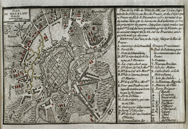
Seven Years War (1756-1763): Map of Breslau and the siege to which it was subjected, 1765. The town was besieged by the Prussian army of Frederick the Great between 7 and 19 December 1757, which successfully engaged a combined Austrian and French force under the command of Soloman Sprecher von Bernegg. On 20 December the Austrian garrison at Breslau surrendered as prisoners of war. On 21 December the Austrians left Breslau through the Schweidnitz Gate, laying down their arms before Frederick II of Prussia. Published in 1765 by the cartographer Jean de Beaurain (1696-1771) as an illustration of his "Great Map of Germany, with the events that took place during the Seven Years War". French edition, 1765.
Crédit
Photo12/Heritage Images/PRISMA ARCHIVO FOTOGRÁFICO, S.L.
Notre référence
HRM25A41_053
Model release
NA
Property release
NA
Licence
Droits gérés
Format disponible
46.0Mo (4.9Mo) / 41.0cm x 28.1cm / 4843 x 3319 (300dpi)