Sujet
Map of the siege of the town of Neisse by General Harsch's Austrian army, 1758 (1765). Creator: Jean de Beaurain.
Légende
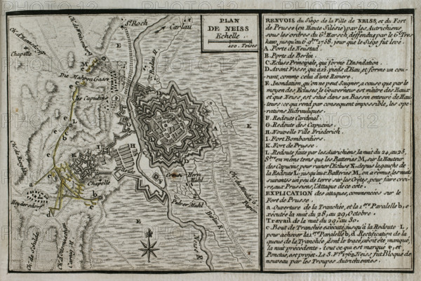
Map of the siege of the town of Neisse by General Harsch's Austrian army, 1758 (1765). On 3rd October 1758, Harsch's troops arrived in Neisse. The main part of the troops encamped on the left bank of the Neisse River, deploying Grenzer hussars and light troops on the right bank to cut off all communications. On 21 October Prussian troops launched their first artillery fire on Austrian positions. On the morning of 26 October, Frederick the Great's Prussian troops took possession of Gorlitz and opened bridges over the Neisse River to move into Silesia and seize the town's fortress. On the night of 5-6 November 1758, Harsch raised the siege of Neisse. Published in 1765 by the cartographer Jean de Beaurain (1696-1771) as an illustration of his "Great Map of Germany, with the events that took place during the Seven Years War", French edition, 1765.
Crédit
Photo12/Heritage Images/PRISMA ARCHIVO FOTOGRÁFICO, S.L.
Notre référence
HRM25A41_035
Model release
NA
Property release
NA
Licence
Droits gérés
Format disponible
47.1Mo (4.6Mo) / 42.0cm x 28.1cm / 4961 x 3316 (300dpi)