Sujet
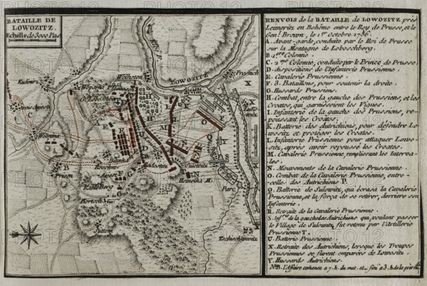
Seven Years War (1756-1763): Map of the Battle of Lobositz or Lovosice (October 1, 1756), 1765. Creator: Jean de Beaurain.
Légende
Seven Years War (1756-1763): Map of the Battle of Lobositz or Lovosice (October 1, 1756), 1765. The Prussian army of Frederick the Great fought against an Austrian army led by Maximilian Ulysses Browne. The Prussians were able to prevent the Austrians from reinforcing their Saxon allies who were under siege at Pirna. Published in 1765 by the cartographer Jean de Beaurain (1696-1771) as an illustration of his "Great Map of Germany, with the events that took place during the Seven Years War". French edition, 1765.
Crédit
Photo12/Heritage Images/PRISMA ARCHIVO FOTOGRÁFICO, S.L.
Notre référence
HRM25A41_023
Model release
NA
Property release
NA
Licence
Droits gérés
Format disponible
47.3Mo (3.7Mo) / 42.0cm x 28.2cm / 4961 x 3331 (300dpi)