Sujet
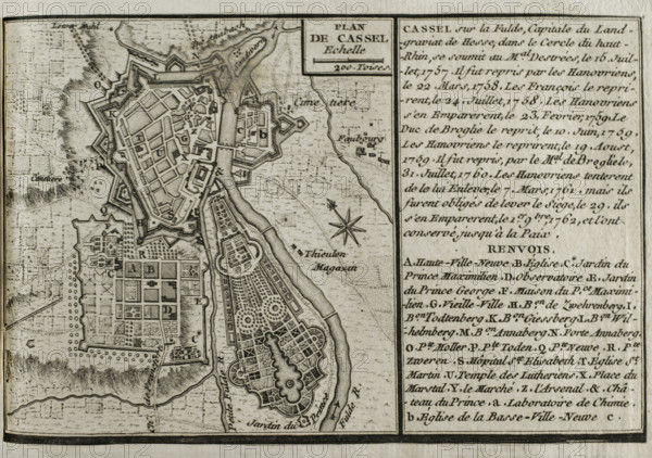
Seven Years War (1756-1763): Map of Cassel, 1757-1762 (1765). Creator: Jean de Beaurain.
Légende
Seven Years War (1756-1763): Map of Cassel, 1757-1762 (1765). The town was besieged between October and November 1762 by an allied force of Hanoverian, Hessian and British troops under the command of the Duke of Brunswick, finally taking it from the French. Published in 1765 by the cartographer Jean de Beaurain (1696-1771) as an illustration of his "Great Map of Germany, with the events that took place during the Seven Years War". French edition, 1765.
Crédit
Photo12/Heritage Images/PRISMA ARCHIVO FOTOGRÁFICO, S.L.
Notre référence
HRM25A41_012
Model release
NA
Property release
NA
Licence
Droits gérés
Format disponible
44.9Mo (3.2Mo) / 40.0cm x 28.2cm / 4724 x 3325 (300dpi)