Sujet
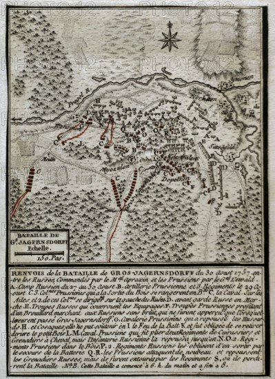
Seven Years War (1756-1763): Map of the Battle of Gross-Jägersdorf (August 30, 1757). Creator: Jean de Beaurain.
Légende
Seven Years War (1756-1763): Map of the Battle of Gross-Jägersdorf (August 30, 1757), East Prussia, 1765. The Russian Army, under the command of Field Marshal Stepan Fyodorovich Apraksin, defeated a smaller Prussian force led by Field Marshal Hans von Lehwaldt. It was the first battle in which Russia took part during the conflict. Published in 1765 by the cartographer Jean de Beaurain (1696-1771) as an illustration of his "Great Map of Germany, with the events that took place during the Seven Years War".
Crédit
Photo12/Heritage Images/PRISMA ARCHIVO FOTOGRÁFICO, S.L.
Notre référence
HRM25A41_005
Model release
NA
Property release
NA
Licence
Droits gérés
Format disponible
44.7Mo (4.1Mo) / 28.5cm x 39.3cm / 3366 x 4640 (300dpi)