Sujet
Seven Years War (1756-1763): Map of the Battle of Rossbach, 1757 (November 5, 1757) 1765. Creator: Jean de Beaurain.
Légende
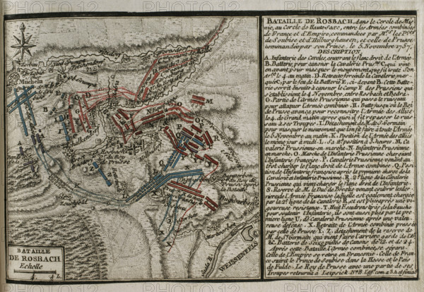
Seven Years War (1756-1763): Map of the Battle of Rossbach, 1757 (November 5, 1757) 1765. Frederick the Great defeated an Allied army composed of French forces augmented by a contingent of the Reichsarmee (Imperial Army) of the Holy Roman Empire, led by Charles de Rohan (Prince de Soubise) and Joseph Friedrich von Sachsen-Hildburghausen. Published in 1765 by the cartographer Jean de Beaurain (1696-1771) as an illustration of his "Great Map of Germany, with the events that took place during the Seven Years War". Allied army in red and the French army in blue. French edition, 1765.
Crédit
Photo12/Heritage Images/PRISMA ARCHIVO FOTOGRÁFICO, S.L.
Notre référence
HRM25A41_041
Model release
NA
Property release
NA
Licence
Droits gérés
Format disponible
46.4Mo (4.6Mo) / 41.0cm x 28.3cm / 4843 x 3347 (300dpi)