Sujet
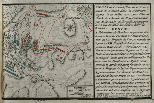
Seven Years War (1756-1763): Map of Battle of Corbach or Korbach (July 10, 1760), 1765. Creator: Jean de Beaurain.
Légende
Seven Years War (1756-1763): Map of Battle of Corbach or Korbach (July 10, 1760), 1765. Northern Heese, Germany. The French troops, led by Marshal Victor-François, 2nd Duke of Broglie, defeated the Hanoverians, British and Hessian allies, commanded by Ferdinand, Duke of Brunswick. Published in 1765 by the cartographer Jean de Beaurain (1696-1771) as an illustration of his "Great Map of Germany, with the events that took place during the Seven Years War". Allied army in red and the French army in blue. French edition, 1765.
Crédit
Photo12/Heritage Images/PRISMA ARCHIVO FOTOGRÁFICO, S.L.
Notre référence
HRM25A41_017
Model release
NA
Property release
NA
Licence
Droits gérés
Format disponible
45.1Mo (3.7Mo) / 41.0cm x 27.6cm / 4843 x 3254 (300dpi)