Sujet
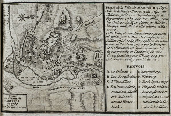
Seven Years War (1756-1763): Map of Marburg and siege of the castle, Hesse, 1759 (1765). Creator: Jean de Beaurain.
Légende
Seven Years War (1756-1763): Map of Marburg and siege of the castle, Hesse, 1759 (1765). Taken by capitulation on 11 September 1759 by the Allied forces under the command of the Count of Buckeburg. Marburg had been captured by the Duke of Broglie on 16 July 1758, being seized again by the French on 30 June 1760. Published in 1765 by the cartographer Jean de Beaurain (1696-1771) as an illustration of his "Great Map of Germany, with the events that took place during the Seven Years War". French edition, 1765.
Crédit
Photo12/Heritage Images/PRISMA ARCHIVO FOTOGRÁFICO, S.L.
Notre référence
HRM25A41_025
Model release
NA
Property release
NA
Licence
Droits gérés
Format disponible
42.8Mo (4.2Mo) / 39.7cm x 27.0cm / 4687 x 3193 (300dpi)