Sujet
Seven Years War (1756-1763): Map of the Battle of Hochkirch (14th October 1758), 1765. Creator: Jean de Beaurain.
Légende
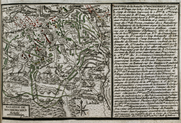
Seven Years War (1756-1763): Map of the Battle of Hochkirch (14th October 1758), 1765. The Prussian army of Frederick the Great faced and was defeated by an Imperial Austrian Army led by Leopold Joseph von Daun. Published in 1765 by the cartographer Jean de Beaurain (1696-1771) as an illustration of his "Great Map of Germany, with the events that took place during the Seven Years War". French edition, 1765.
Crédit
Photo12/Heritage Images/PRISMA ARCHIVO FOTOGRÁFICO, S.L.
Notre référence
HRM25A41_009
Model release
NA
Property release
NA
Licence
Droits gérés
Format disponible
45.8Mo (2.7Mo) / 41.0cm x 28.0cm / 4843 x 3307 (300dpi)