Sujet
Seven Years War (1756-1763): Map of Dresden, 1760 ( 1765). Creator: Jean de Beaurain.
Légende
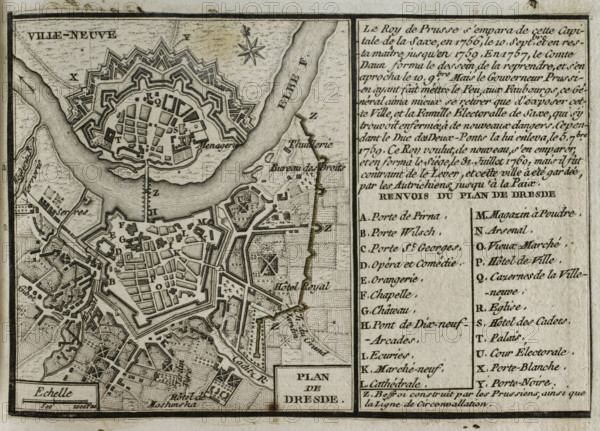
Seven Years War (1756-1763): Map of Dresden, 1760 ( 1765). The siege of Dresden (July 1760) took place during the Third Silesian War. Prussian army under the command of Frederick the Great unsuccessfully besieged the city. Published in 1765 by the cartographer Jean de Beaurain (1696-1771) as an illustration of his "Great Map of Germany, with the events that took place during the Seven Years War". French edition, 1765.
Crédit
Photo12/Heritage Images/PRISMA ARCHIVO FOTOGRÁFICO, S.L.
Notre référence
HRM25A40_500
Model release
NA
Property release
NA
Licence
Droits gérés
Format disponible
45.9Mo (3.6Mo) / 40.0cm x 28.7cm / 4724 x 3395 (300dpi)