6058 résultats pour : coastal
- Page
-
- sur
- 61
Connectez-vous pour plus de résultats
HRM25A32_211
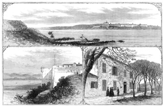
The Island and Fort of St. Marguerite, the prison ...
HRM25A33_090
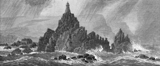
New lighthouse, Corbiere Rocks, Jersey, 1874. Crea...
HRM25A33_178
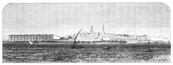
The French in Tunis: the town of Sfax, from the an...
HRM25A33_223
The Tourist in Scotland: John O' Groat's, 1881. Cr...
HRM25A27_347
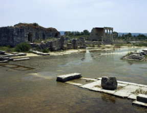
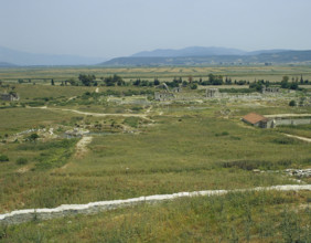
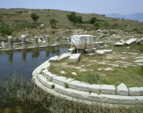
Ruins of northern agora near Holy Road, Miletus, A...
HRM25A33_208
Sketches at the Ryde Regatta: The Wind-Up, 1881. C...
HRM25A23_310
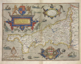
Map of Cornwall, 1579. Creator: Christopher Saxto...
HRM25A23_458
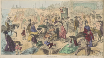
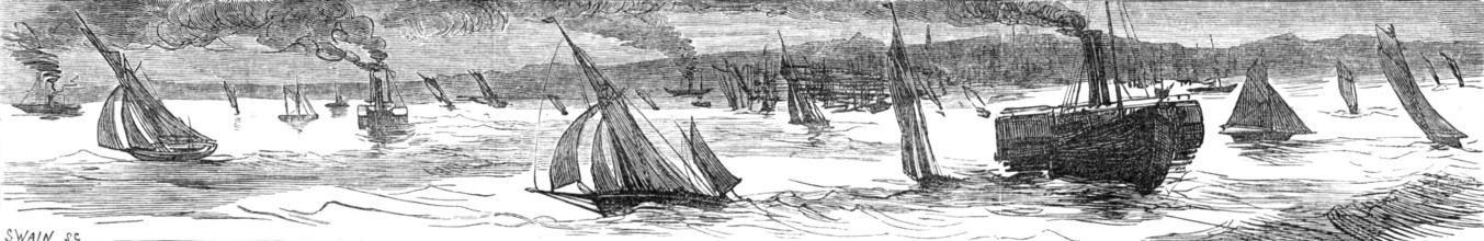
Ramsgate Sands, 1870. Creator: Joseph Swain.
HRM25A33_209
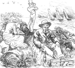
Sketches at the Ryde Regatta: Scudding Home, 1881....
HRM25A26_338
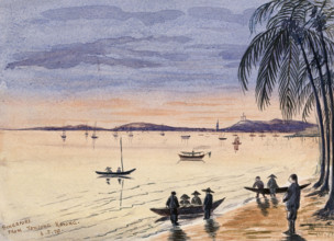
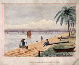
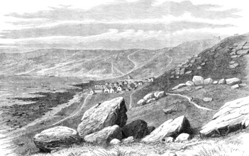
Singapore: view towards Singapore from the beach a...
HRM25A26_337
Singapore: view along the beach by Singlap, 1879. ...
HRM25A23_304
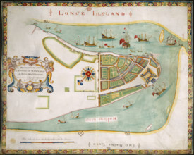
A Description of the Towne of Mannados or New Amst...
HRM25A27_350
North agora, near via Sacra, Miletus, Anatolia, Tu...
HRM25A33_007
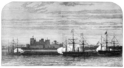
Bombardment of Fort Masnaah, Gulf of Oman, 1874. C...
HRM25A33_169
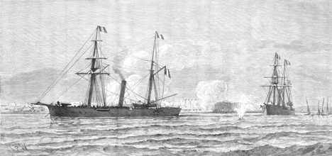
The White Star steam-ship Britannic aground off Ke...
HRM25A33_279
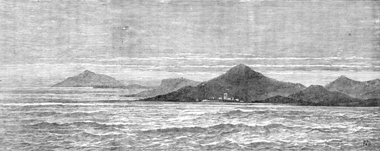
Quoin Point, Cape Agulhas, South Africa, near whic...
HRM25A23_395
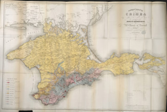
Geological map of the Crimea, 1853. Creator: Unkno...
HRM25A26_346
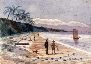
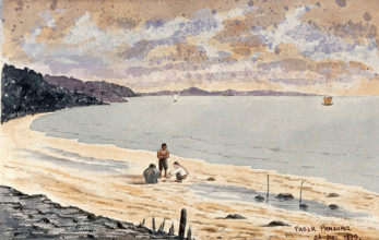
Singapore: a view along the beach at Pasar Panjong...

HRM25A33_116
A peep from the churchyard, St. Anthony, Cornwall,...
HRM25A33_179
The French in Tunis: bombardment of Sfax by the Fr...
HRM25A23_460
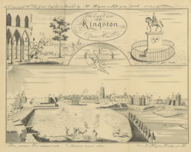
The East View of Kingston Upon Hull, 1735, (1869)....
HRM25A32_250
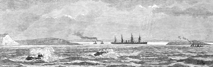
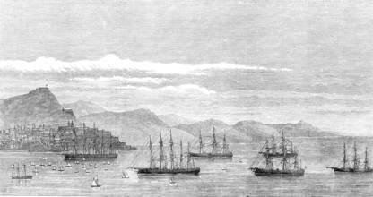
The Channel Fleet Regatta at Vigo, 1874. Creator: ...
HRM25A33_113
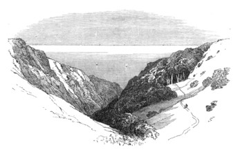
Frathy Valley, Cornwall, 1874. Creator: Unknown.
HRM25A23_037
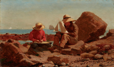
The Boat Builders, 1873. Creator: Winslow Homer.
HRM25A25_440
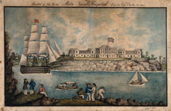
Malta: Royal Naval Hospital or Bighi Hospital, wit...
HRM25A26_333
Singapore: view from the beach at Tanjong Katong, ...
HRM25A27_160
Pinewood Studios, Iver Heath, Iver, Buckinghamshir...
HRM25A27_351
Ruins of Monument at the Harbour of Lions, Miletus...
HRM25A23_433
Detail (left-hand end) of a panoramic map of the c...
HRM25A27_114
Still from "Operational Height", 1942. Creator: Ro...

HRM25A27_123
RAF Iver Heath, Iver, Buckinghamshire, 1943. Creat...
HRM25A33_195
By The Sea, 1881. Creator: Eugène Froment.
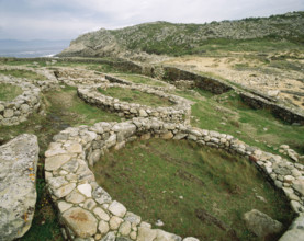
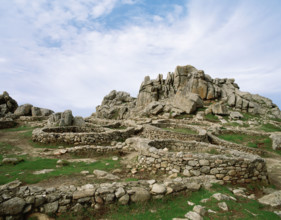
HRM25A27_400
Castro de Barona, Galicia, Spain, Celtic Period, (...
HRM25A27_113
Still from "Operational Height", 1942. Creator: Ro...
HRM25A33_196
Whitsand Bay, Land's End, Cornwall, where the new ...
HRM25A33_205
Sketches at the Ryde Regatta: "Far from the Maddin...
HRM25A23_280
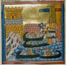
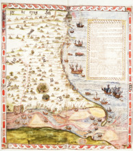
Naval battle between the fleets of Crete and Athen...
HRM25A23_489
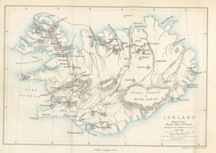
Iceland, Reduced from Olsens' Map of Iceland, 1867...
HRM25A27_401
Castro de Barona, Galicia, Spain, Celtic Period, (...
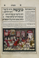
HRM25A23_301
The Rabbis of Bene Brak, 1740. Creator: Unknown.
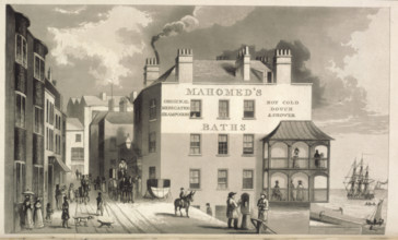
HRM25A23_335
Mahomed's Baths, 1826. Creator: William Maddocks.
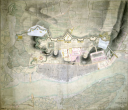
HRM25A23_436
A Plan of Chatham Lines, May 18th 1804. Creator: ...

HRM25A24_051
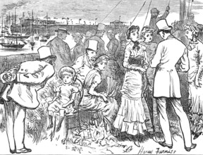
'"They are not worth your having, Miss", he says, ...

HRM25A14_481
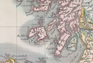
Map of Scotland, (c1800?). Divided into counties, ...
HRM25A15_100
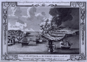
The Battle of Bunker Hill and the burning of Charl...
HRM25A16_221
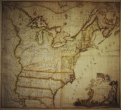
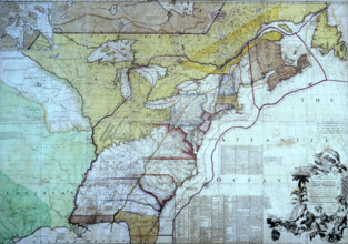
Map of the United States of North America, 1783. D...
HRM25A17_205
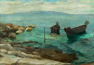
Seascape, early 20th century.
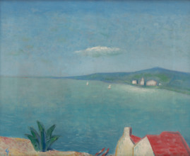
HRM25A18_191
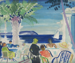
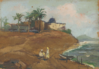
French Riviera, 1920.
HRM25A19_195
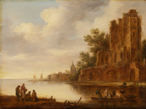
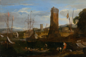
Coastal landscape with ruin, 1635-1646. Ferrying c...
HRM25A20_179
By the Dalmatian Sea, around 1930.
HRM25A16_480
On the Coast, 1870-1890. Probably by Antonín Chitt...
HRM25A14_492
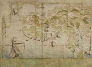
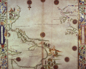
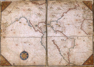
Chart of the Atlantic Ocean, c1535-1542. The map i...
HRM25A15_102
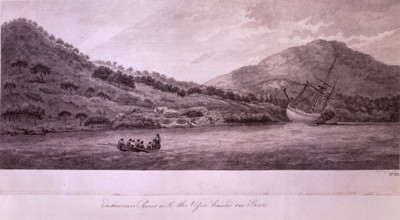
Endeavours River with the Vessel hauled on the Sho...
HRM25A15_426
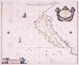
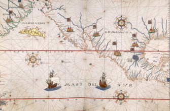
Map of California, 1666. 'Paskaerte Van Nova Grana...
HRM25A17_203
Sea IV, early 20th century.
HRM25A14_480
Detail from a map of Scotland, (c1800?). Showing s...
HRM25A14_491
Map of Mexico, 1567. Mexico, conquered by the Span...
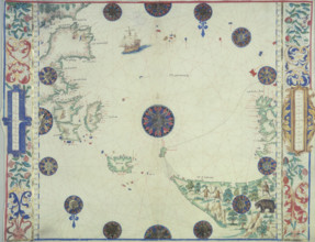
![Map of Great Britain and Ireland, c1564-c1570. 'A general description of England & Irelad [sic]](https://lres.photo12.com/th/t-hrm25a14_268.jpg)
HRM25A14_268
Map of Great Britain and Ireland, c1564-c1570. 'A ...
HRM25A15_101
Map of the British Colonies in North America, c177...
HRM25A15_425
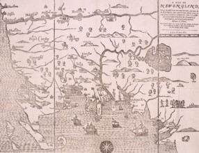
Map of New England, 1677. Self-proclaimed as the f...
HRM25A16_378
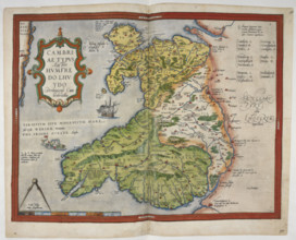
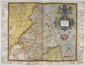
Coloured printed map of Wales and Anglesey, 1579. ...
HRM25A14_278
Chart of the Gulf of Mexico and the Pacific Ocean,...

HRM25A14_485
The island of Islay, 1564. 'L Aruny, Mac Foyn Cann...
HRM25A15_031
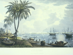
A view of Calcutta from a. Point opposite to Kidde...
HRM25A15_420
Map of the Atlantic coast of Portugal, 1682. 'Pasc...
HRM25A16_377
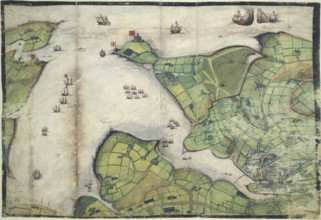
Coloured manuscript plan of Falmouth Haven, or Har...
HRM25A14_277
Map of the Black Sea coastline, 1536. The coast of...
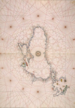
HRM25A14_378
Map of New Zealand, 1778. 'La Nuova Zelanda trasco...
HRM25A14_486
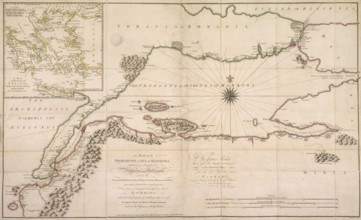
Map of the Sea of Marmara, 1770. The sea of Marmar...

HRM25A15_103
Map of Botany Bay, New South Wales, Australia, 177...
HRM25A15_419
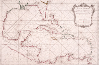
Map of the Gulf of Mexico, 1772. 'Carte Reduite du...
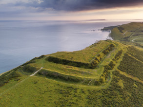
HRM25A13_457
Flower's Barrow, East Lulworth, Dorset, 2024. Obli...
HRM25A19_236
The Adriatic, 1935.
HRM25A15_422
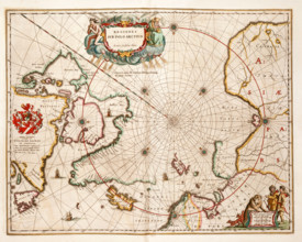
Map of the Arctic, 1662. 'Regiones sub Polo Arctic...
HRM25A15_421
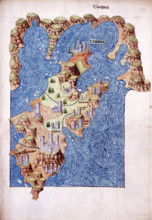
Mitilena (Lesbos), c1485. Mytilene is the capital ...
HRM25A16_427
Seaside Landscape I, 1660.

HRM25A13_455
General view of the Fleetwood Nautical College Rad...
HRM25A14_274
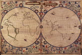
World Map, 1562. The map suggests that North Ameri...
HRM25A14_283
World Map, 1542. On the left is the 'New World', t...
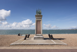
HRM25A13_456
General view of the memorial to the officers, seam...
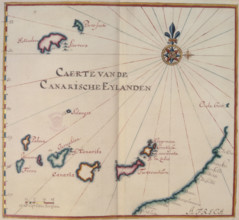
HRM25A14_284
Map of the Canary Islands, 17th century. 'Caerte v...
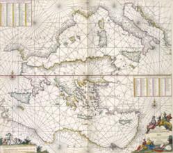
HRM25A14_497
Maps of the Mediterranean, 1682. The upper half is...
HRM25A17_209
Landscape with figures, early 20th century.
HRM25A17_238
Seashore, 1900.
HRM25A20_207
On the coast, 1913.
HRM25A13_490
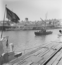
A view of the harbour at Weymouth showing various ...
HRM25A14_260
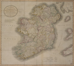
'A New Map of Ireland', 1799. 'A New Map of Irelan...
HRM25A14_275
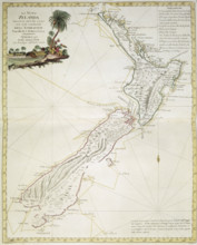
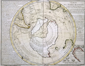
Map of Australasia and Antarctica, 1739. 'Cartes d...
HRM25A15_381
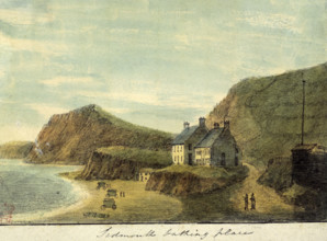
'Sidmouth Bathing Place', Devon, 1797. The first o...
HRM25A16_379
Engraved map of Northumberland, from drawings of C...
HRM25A17_223
Sea II, early 20th century.
HRM25A15_417
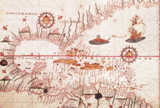
Map of the Caribbean, c1578. Showing 'Niova Spagna...
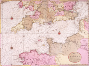
HRM25A15_430
Map of the English Channel, 1693. 'Carte de la Man...
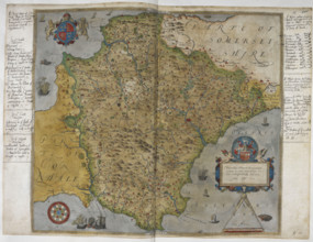
HRM25A16_380
Printed map of Devon, dated 1575, with marginal no...
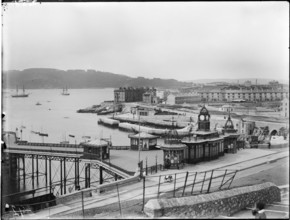
HRM25A13_496
A view looking south-west from Plymouth Hoe toward...
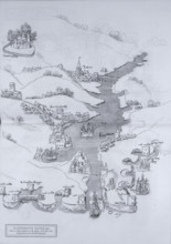
HRM25A14_468
A map of Dartmouth Haven, Devon, 1806. 'From a Cha...
HRM25A15_396
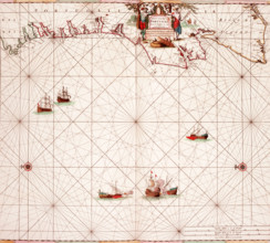
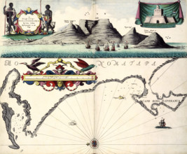
A Draught of Cape Bona Esperanca by Iohn Seller Hy...
HRM25A15_418
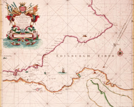
Map of the Firth of Forth, 1689. The first British...
HRM25A15_427
Map of the River Humber and land between Hull and ...
HRM25A14_263
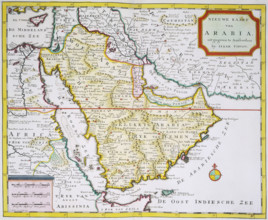
Map of Arabia, 1744. 'Nieuwe Kaart van Arabia. uit...
- Page
-
- sur
- 61