Légende
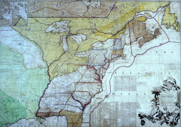
Map of the British Colonies in North America, c1770-c1783. This map is the one on which the British negotiators for peace with the Americans marked out their interpretation of the boundary between the United States and the provinces which later formed Canada. The new border was marked in red, so the map became known as the 'Red-lined map'. It was presented to George III to show him how the settlement worked on the ground. As the map was not included in the final treaty and as the printed map itself contained inaccuracies, further arbitration was later required. In full: 'Map of the British Colonies in North America with the Roads, Distances, Limits and Extent of the Settlements, Humbly Inscribed to the Right Honourable The Earl of Halifax And the Other Right Honourable The Lords commissioners for Trade & Plantations'. Colonial American physician and botanist John Mitchell (1711-1768) created the most comprehensive and perhaps largest 18th-century map of eastern North America, known today as the Mitchell Map. First published in 1755, in conjunction with the imminent Seven Years' War, the map was subsequently used during the Treaty of Paris (1783) to define the boundaries of the newly independent United States and has been resolving border disputes since.
Date
1770
Crédit
Photo12/Heritage Images/Heritage Art
Notre référence
HRM25A15_101
Model release
NA
Property release
NA
Licence
Droits gérés
Format disponible
50.6Mo (3.1Mo) / 42.5cm x 29.8cm / 5022 x 3521 (300dpi)