Légende
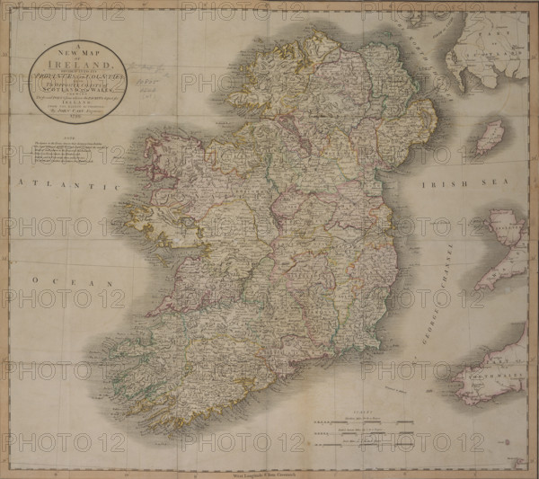
'A New Map of Ireland', 1799. 'A New Map of Ireland, divided into its Provinces and Counties; also, The Opposite Coasts of Scotland and Wales; shewing The several Ports from whence the Packets depart for Ireland. From the latest authorities. Note. The figures to the Towns denote their distance from Dublin. The Stars annexed signify Borough Towns & express the number of Members each return to the Imperial Parliament. Viz. Thirty one Towns return one Member each. Dublin and its University three, and Cork two. The thirty two Counties also return two Members each'.
Date
1799
Crédit
Photo12/Heritage Images/Heritage Art
Notre référence
HRM25A14_260
Model release
NA
Property release
NA
Licence
Droits gérés
Format disponible
49.9Mo (7.8Mo) / 37.5cm x 33.4cm / 4430 x 3939 (300dpi)