Légende
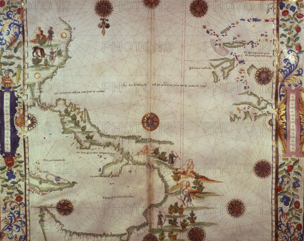
Chart of the Gulf of Mexico and the Pacific Ocean, 1542. The map is orientated 'upside down' to our modern eyes: parts of the north coast of South America - eg 'Perou' - appear at the top, and parts of the south coast of North America - eg 'The lande of Florida' - appear at the bottom. 'The Couba' (Cuba), is at far left. Native Americans are depicted engaged in hunting with bow and arrow. From "Portolano" or 'Boke of Idrography' by John Rotz (The 'Rotz Atlas'), dedicated to King Henry VIII.
Date
1542
Crédit
Photo12/Heritage Images/Heritage Art
Notre référence
HRM25A14_278
Model release
NA
Property release
NA
Licence
Droits gérés
Format disponible
50.0Mo (6.7Mo) / 39.7cm x 31.5cm / 4690 x 3723 (300dpi)