Légende
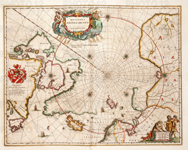
Map of the Arctic, 1662. 'Regiones sub Polo Arctico'. Despite their forbidding nature, the arctic regions constantly attracted European mariners. The great lure was the prospect of discovering new routes to the east to outflank the Spanish. This map defines the eastward and westward limits of knowledge which endured until the 19th century. Novaya Zemlya and Spitzbergen were reached by Barents in 1594-1596, while the discovery between 1610 and 1616 by Baffin and Hudson of the vast bays which bear their names set the stage for the search for a north-west passage to the Pacific.
Date
1662
Crédit
Photo12/Heritage Images/Heritage Art
Notre référence
HRM25A15_422
Model release
NA
Property release
NA
Licence
Droits gérés
Format disponible
49.9Mo (5.4Mo) / 39.6cm x 31.6cm / 4676 x 3731 (300dpi)