3882 résultats pour : maps
- Page
-
- sur
- 39
Connectez-vous pour plus de résultats

HRM26A26_179
Martin Behaim, (1459-1507), German textile merchan...

HRM26A26_197
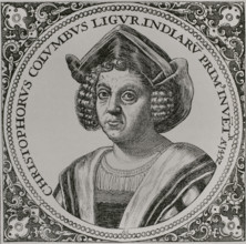
Christopher Columbus, (1451-1506), Navigator, cart...
HRM26A26_196
Christopher Columbus, (1451-1506), Navigator, cart...
HRM26A22_214
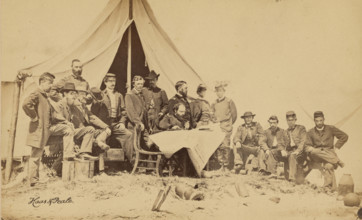
General Gillmore & Staff, 1863. Creator: Haas & Pe...

HRM26A26_198
Christopher Columbus, (1451-1506), Navigator, cart...

HRM26A26_195
Christopher Columbus, (1451-1506), Navigator, cart...
HRM26A15_020
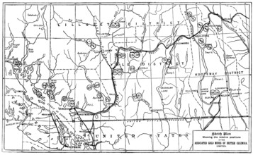
Gold in British Columbia: plan of the associated g...
HRM26A15_159
The Chinese Question: map showing positions of chi...
HRM26A14_274
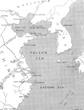
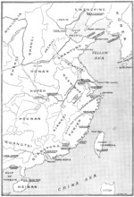
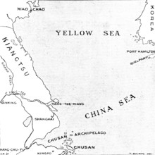
The Chinese Crisis: positions of Port Arthur and K...
HRM26A15_259
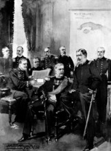
The Spanish-American Crisis: prominent officers of...
HRM26A15_483
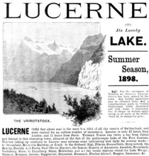
Advertisement for trips to Lake Lucerne, 1898. Cre...
HRM26A15_132
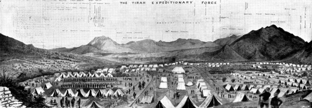
With the Tirah Expeditionary Force: bird's eye vie...
HRM26A21_109
Christopher Columbus, (1451-1506), Navigator, cart...
HRM26A14_279
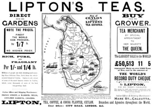
Advertisement for Lipton's Teas, 1898. Creator: Un...
HRM26A15_140
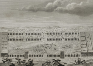
The British Expedition from Accra to the Gold Coas...
HRM26A15_441
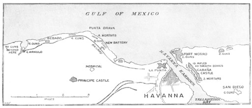
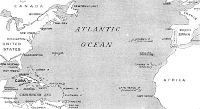
The Spanish-American War: the defences of Havana.....
HRM26A14_488
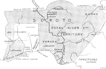
The French in West Africa: map with shaded portion...

HRM26A13_410
Portrait of Isaac Commelin, 1669. Creator: Gerbran...

HRM26A15_124
Advertisement for Fry's Pure Concentrated Cocoa, 1...

HRM26A13_311
The Geographer, 1669. Creator: Jan Vermeer.
HRM26A20_308
An army during the Roman conquest of the Iberian P...
HRM26A15_026
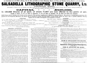
Advertisement for the Salsadella Lithographic Ston...
HRM26A14_305
The Chinese Crisis: relative positions of the isla...

HRM26A15_018
H.M. the King of Spain, Alphonso XIII., 1898. Crea...
HRM26A15_277
The Spanish-American War: map illustrating the rel...

HRM26A20_241
Michael Servetus, (1511-1553), Spanish physician a...
HRM26A15_049
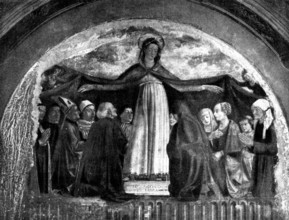
Fresco by Ghirlandajo discovered in the Church of ...
HRM26A15_229
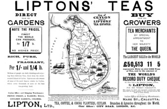
Advertisement for Liptons' Teas, 1898. Creator: Un...
HRM26A20_427
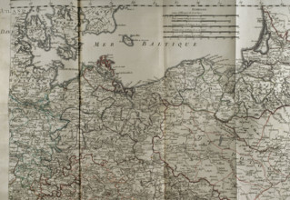
Map of the Baltic Sea coast, Prussia and Poland - ...
HRM26A20_301
A Roman camp at the time of the Roman invasion of ...
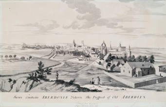
HRM26A02_379
The Prospect of Old Aberdeen, 1814. Creator: Unkno...
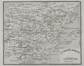
HRM26A06_149
Map of Roman Hispania, 1852. Creator: Unknown.
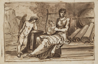
HRM26A01_194
Female Figure (Geography?) with a Lyre, Globe, Map...
HRM26A06_169
Napoleon III, (Louis Napoleon Bonaparte) (1808-187...
HRM26A06_150
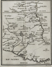
Map of the territory of New Spain, 1771. Creator:...
HRM26A02_436
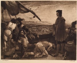
Dawn Revealing the New World to Columbus, (c1852),...
HRM26A04_345
General Sir Peter Lumsden GCB, CSI, DL (1829-1918)...
HRM26A08_198
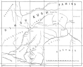
Sketch map of the Chitral Campaign, 1895. Creator:...
HRM26A00_269
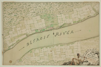
Fort Detroit and Its Environs, between 1763 and 17...
HRM26A07_337
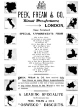
Advertisement for Peek, Frean & Co., biscuit manuf...
HRM26A03_256
Mr. Willend, c1870s. Creator: James Faed.
HRM26A09_105
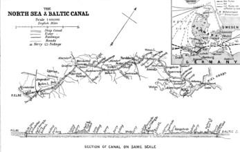
The Opening of the Baltic Canal: map and section o...
HRM26A08_334
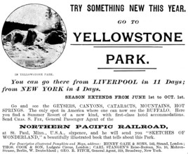
Advertisement for the Northern Pacific Railroad, 1...
HRM25A55_435
Representation of the city of Mexico (Mexico-Tenoc...
HRM25A56_400
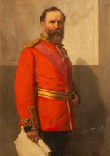
Captain R. H. Nelson, 1890. Creator: Unknown.
HRM25A52_264
Aerial map of Brisbane showing North Brisbane, Sou...

HRM25A55_110
Tourist Map of the New Forest and District, c1900....
HRM25A58_038
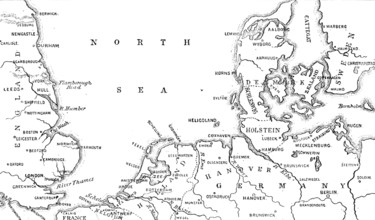
Map showing the position of Heligoland, 1890. Crea...
HRM25A58_085
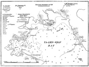
Plan of Ta-Lien-Whan Bay, captured by the Japanese...
HRM25A53_109
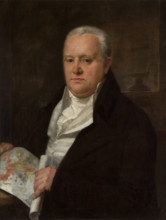
John Montresor, c1771. Creator: John Singleton Cop...
HRM25A57_327
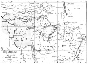
Map showing the Great Forest traversed by Mr. Stan...
HRM25A57_417
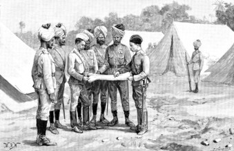
Sketches of the Military Police of Burmah: studyin...
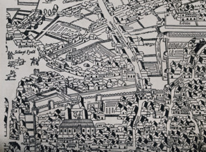
HRM25A55_042
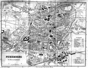
City Map - Nuremberg, 1900. Creator: Unknown.
HRM25A55_190
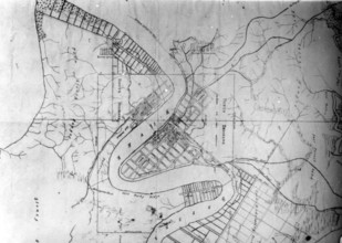
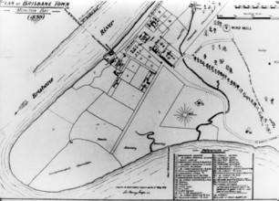
Plan of Brisbane town, Moreton Bay 1839 Geo. Barne...
HRM25A57_226
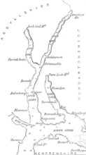
Map of Loch Long with Loch Goil, 1890. Creator: Un...
HRM25A56_090
Death of Columbus, 1890. Creators: Juan Alaminos,...
HRM25A58_034
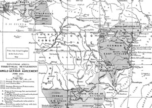
Map of the British and German Possessions in Afric...
HRM25A55_043
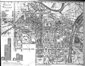
City Map - Turin - Torino, 1900. Creator: Unknown.

HRM25A57_323
Meeting of the Royal Geographical Society...in the...

HRM25A54_217
The Cardinal's Leisure, mid or late 19th century. ...
HRM25A57_353
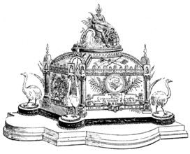
Casket of Freedom of City of London presented to M...
HRM25A52_319
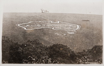
Large map of Australia carved into the chalk downs...
HRM25A52_318
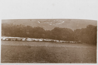
Large map of Australia carved into the chalk downs...

HRM25A55_365
Grand Duke Ferdinand II of Tuscany, mid 17th centu...
HRM25A56_119
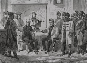
Franco-Prussian War (1870-1871): Armistice ceremon...
HRM25A47_033
Manuscript map of Lancashire, drawn c1576-1590. C...
HRM25A46_482
Plan depicting the siege by Sir John Perot, Lord P...
HRM25A46_483
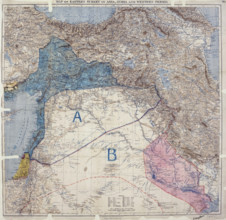
Map showing Eastern Turkey in Asia, Syria and West...
HRM25A47_036
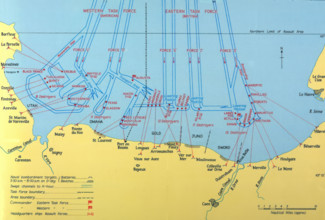
Naval Bombardments on D-Day, Second World War. Cr...

HRM25A46_223
Unity of Strength - Inter-allied posters: 'Liberté...
HRM25A46_484
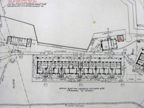
Msida Bastion - Married Soldiers Quartier, 1906. C...
HRM25A47_070
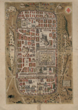
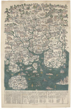
Ierusalem, et suburbia eius. Map of Jerusalem in C...
HRM25A50_202
Map of the Balloon Voyage from Hastings to Boulogn...
HRM25A50_392
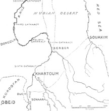
Map of the central region of the Soudan, 1883. Cre...
HRM25A49_269
Map of Guangdong Province, c.1739. Creator: Anonym...
HRM25A50_011
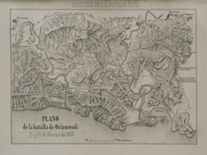
Plan of the Battle of Oriamendi (15 and 16 March 1...
HRM25A45_107
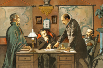
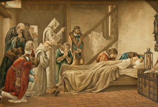
Listening to the Nuncio during the election of Sta...
HRM25A47_071
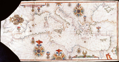
Nautical chart of the Mediterranean Sea, Early16th...
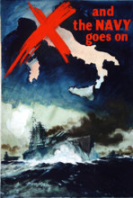
HRM25A46_139
'And the Navy Goes on', British propaganda poster,...
HRM25A43_445
The Church of St Bartholomew the Great; a map of ...
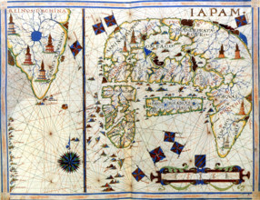
HRM25A48_491
Nautical chart of Japan and Korea, 1568. Creator: ...
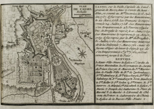
HRM25A41_012
Seven Years War (1756-1763): Map of Cassel, 1757-1...
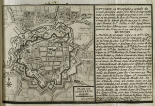
HRM25A41_021
Map of Lippstadt (Germany), 1757-1758 (1765). Crea...
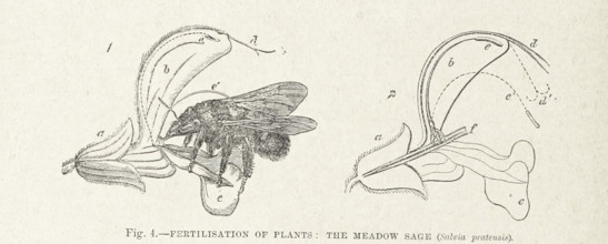
HRM25A33_407
Fertilisation of Plants: the Meadow Sage (Salvia p...
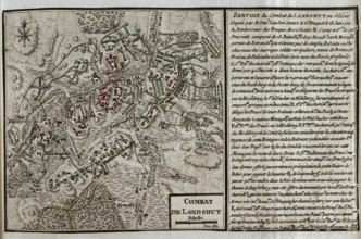
HRM25A41_011
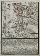
Map of the Battle of Landeshut (June 23, 1760), Se...
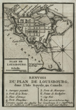
HRM25A41_022
Map of Louisbourg, Nova Scotia, Canada, 1765. Cre...

HRM25A33_413
Maria Theresa in Coronation Dress..., 1895. Creato...
HRM25A39_205
Portrait of Wincenty Laskiewicz, c1810, 1799-1805....
HRM25A41_010
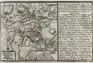
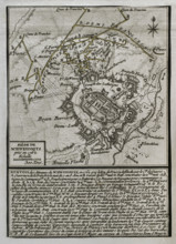
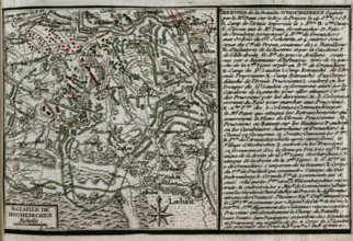
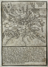
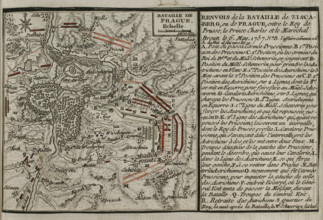
Seven Years War (1756-1763): Map of the Battle of ...
HRM25A41_019
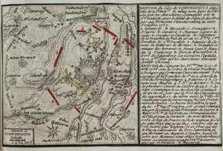
Seven Years War (1756-1763): Battle of Kunersdorf ...
HRM25A41_037
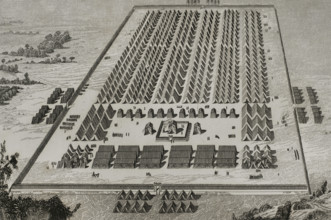
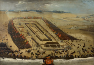
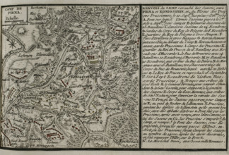
Seven Years War (1756-1763): Map of the encampment...
HRM25A41_048
Seven Years War (1756-1763): Third Silesian War - ...
HRM25A42_213
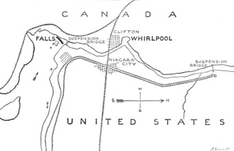
Map of the Rapids and Whirlpool below the Falls of...
HRM25A41_009
Seven Years War (1756-1763): Map of the Battle of ...
HRM25A41_020
Seven Years War (1756-1763): Third Silesian War - ...
HRM25A41_038
Seven Years War (1756-1763): Map of the Battle of ...
HRM25A41_047
Seven Years War (1756-1763): Third Silesian War - ...
HRM25A40_498
Seven Years War (1756-1763): Third Silesian War - ...
HRM25A41_007
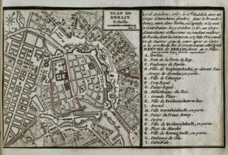
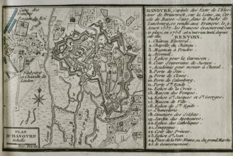
Map of Hannover, 1757-1758 (1765). Creator: Jean ...
HRM25A41_016
Seven Years War (1756-1763): Map of the Siege of C...
- Page
-
- sur
- 39